Background of the Sevier River and the DMAD Dam
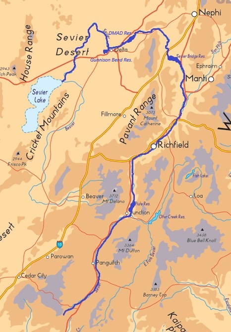
The Sevier River is approximately 400 miles long and is contained entirely within the state of Utah. Beginning in south-central Utah, it flows north through canyons and valleys until it reaches Leamington Canyon, southwest of Nephi, Utah, where the river turns west and then south. It continues southwest across the Sevier Desert, ending in Sevier Lake, a terminal lake. The river is used extensively for irrigation of agricultural lands along its course. Early irrigators struggled to maintain simple brush and rock diversion dams, which washed out almost annually. A severe drought in the late 1890s led to conflicting water claims and water distribution disputes between water users. To mitigate the effects of years with drought and years with flooding, several reservoirs were built along the river to provide a stable supply of irrigation water and to regulate river flows. The major storage facilities (from upstream to downstream) included Otter Creek, Piute, Sevier Bridge, and Gunnison Bend dams. The drainage basin was legally divided into two managed systems, the upper and the lower Sevier River. In 1936, the entire river system was placed under the Cox Decree to resolve conflicts between the two sections. By this decree and subsequent operating convention, river commissioners were tasked with ensuring the aforementioned reservoirs were regulated to be as full as possible at the beginning of each irrigation season. However, there was no formal mechanism to coordinate basin operations in the lower and upper sections during high-runoff emergencies.
Downstream of the Sevier Bridge dam and near the town of Delta, Utah, agricultural development expanded under the Carey Act of 1894, which established the Delta Project. Water management below Sevier Bridge Reservoir came under the direction of four private entities: the Delta Canal Company, Melville Irrigation Company, Abraham Irrigation Company, and Deseret Irrigation Company. In the winter of 1959–1960, these four companies cooperatively constructed DMAD Dam and Reservoir (the name derived from the initials of the four companies) approximately 5 miles northeast of Delta. The reservoir was built to impound 11,000 acre-feet of water. Its construction, along with the Gunnison Bend reservoir downstream, addressed winter water rights storage and improved regulation of flows in the lower river. DMAD reservoir would also provide water to the Intermountain Power Project, whose construction began in the fall of 1981, for power generation.
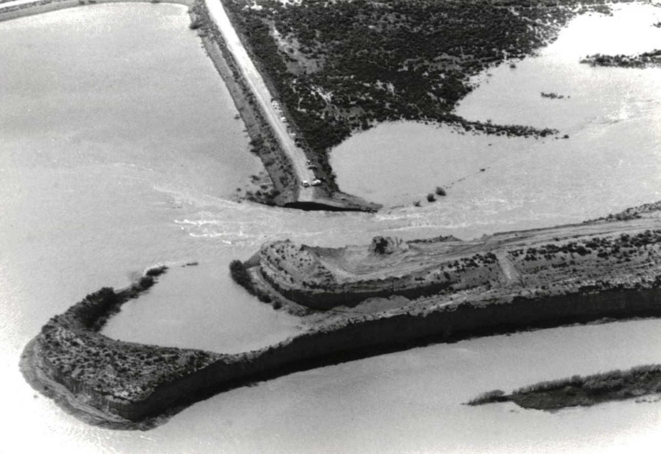
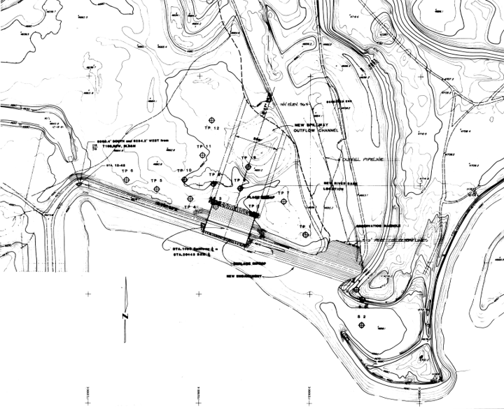
The DMAD dam is an L-shaped earthfill embankment beginning on the south bank of the Sevier River and extending 900 feet north across the river channel and then 1,500 feet east along the floodplain. The 48-inch low-level outlet’s intake is set at elevation 4,648 feet and has a reported capacity of 950 cfs. An uncontrolled, concrete spillway was constructed at the east end of the embankment with its crest set at elevation 4,666 feet—the full reservoir pool elevation. The spillway discharged into a concrete stilling basin at elevation 4,656 feet. The elevation of the dam’s crest was 4,673 feet.
Approximately three-quarters of a mile downstream of the DMAD spillway, at the site of the old Delta-Melville diversion dam, the river profile dropped 24 feet into the natural channel below (elevation 4,632 feet). To step this gradient down, designers incorporated the old 1912 Delta-Melville diversion spillway into the design of DMAD to serve as a drop structure and downstream grade control. The crest of this downstream drop structure sat at elevation 4,647 feet. Because a highly erodible sand layer lay between elevations 4,632 and 4,637 feet, the structural stability of the DMAD spillway and stilling basin rested entirely on the integrity of this downstream drop structure, although it had substantially less hydraulic capacity than the DMAD spillway, would become submerged during high flows, and had no access for emergency maintenance.
1983 Water Conditions in Utah
The hydrological conditions that developed in 1983 were unprecedented across Utah. In September 1982, heavy precipitation fell over the Sevier River drainage, thoroughly saturating basin soils and halting late-season irrigation demand. The Reservoirs along the Sevier River were nearly filled. With carry-over storage already occupying most reservoir capacity, the river commissioner began releasing surplus water toward Sevier Lake on November 11, 1982.
Runoff management through the winter and spring was complicated by inaccurate runoff forecasts and the absence of formal protocols to coordinate basin operations between the lower and upper sections of the river during high runoff. The January 1, 1983, official forecast prepared jointly by the National Weather Service and the Soil Conservation Service projected that the high runoff period of April through July would result in 85,000 acre-feet of water into Sevier Bridge Reservoir. This was 10,000 acre-feet less than what the reservoir had received in the last three months of 1982. This runoff projection remained unchanged in the February 1 and March 1 bulletins and likely led to a sense of complacency in managing the near-full reservoirs along the Sevier River. In reality, inflows into Sevier Bridge between October 1982 and February 1983 totaled more than 150,400 acre-feet as measured by the river commissioner. The April 1 forecast raised expected inflows to 135,000 acre-feet, but forecasts continued to lag well behind physical conditions. Additionally, with no formal process to coordinate the management of the reservoirs on the Sevier, water was held or released as deemed necessary for individual facilities rather than the needs of the system as a whole.
By February 18, 1983, river inflows had exceeded the outlet capacity of DMAD Dam, to the point that reservoir water began flowing over the spillway crest. As discharge increased, backwaters created by the 1912 downstream drop structure submerged the low-level outlet, reducing its overall discharge capacity. Then, in late May, weather conditions shifted abruptly from unseasonably cold temperatures to record warmth. Rapid snowmelt caused by rising temperatures resulted in runoff waters surging throughout the basin, destroying diversion structures along the Sevier River and eliminating the ability to divert water into irrigation canals. Peak inflows to Sevier Bridge Reservoir exceeded 6,500 cfs, far above the historical record of 2,260 cfs established in 1922. The 1922 record river discharge at the town of Deseret, downstream of Gunnison Bend Reservoir, was 1,650 cfs. This record flow was exceeded in March of 1983. By the first of May, there was concern that flows in the river would exceed spillway capacities and place reservoirs in jeopardy. In an arid state like Utah, water is not wasted. Farmers in the Delta area refer to any water sent to Sevier Lake as “wasted,” but in 1983 more than 700,000 acre-feet were discharged toward Sevier Lake. The previous maximum release to the lake was 173,000 acre-feet.
Spillway Failure
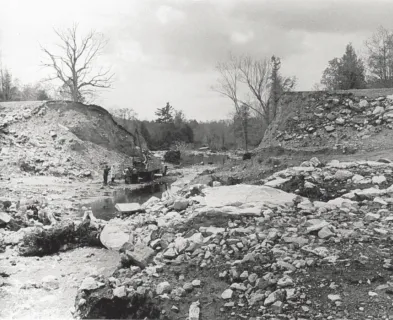
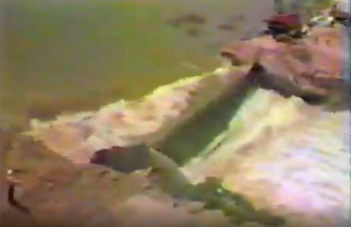
By June, the DMAD Reservoir was severely surcharged. The reservoir held upward of 16,000 acre-feet of water—just over 145 percent of its rated storage capacity—with the reservoir gage reading nearly five feet above full pool and just two feet below the dam crest. The 1912 drop structure had been submerged for several weeks, subjecting its foundation to intense hydraulic scour and vibrations. Then, on June 15, the concrete floor slab of the drop structure sheared away from the abutment wing walls and collapsed into the scoured plunge pool. The loss of the drop structure exposed the underlying saturated, erodible sand layers to the full gradient of the river. The swollen river began eroding the spillway channel, moving upstream toward the DMAD spillway stilling basin. Attempts were made to arrest the headcut by placing riprap and old cars filled with concrete into the spillway channel with a 100-foot crane and other construction equipment supplied by the nearby Intermountain Power Project, which was under construction. Despite the efforts, the head cutting continued to advance at times reaching an erosion rate of one foot per minute. By the morning of June 23, the back cutting erosion reached the DMAD stilling basin and scoured the fine foundation material supporting the east wing wall. Around 1:00 pm, the spillway structure tilted, pivoted on its axis, and collapsed into the downstream scour hole. The breach unleashed an estimated peak discharge of 30,000 cfs, with the average flow for June 23 recorded at 13,100 cfs.
Damages Caused by the Flood
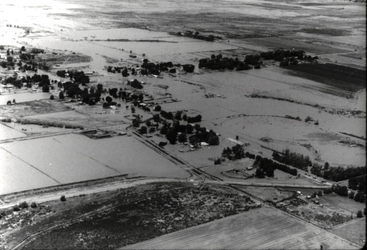
The sudden release of approximately 16,000 acre-feet of water from DMAD reservoir caused over $3 million in structural damage. Damages to surrounding private property and agriculture were estimated to be worth an additional $3 million.
Situated 8 miles downstream, Gunnison Bend Reservoir held an estimated 5,000 acre-feet. To prevent the DMAD flood wave from overtopping and breaching the dam, compounding the flood wave, officials intentionally breached the embankment. This release evacuated storage from Gunnison Bend reservoir ahead of the flood surge from DMAD, preventing a higher peak flow downstream from the combined breach flows.
Downstream communities were warned shortly before the breach occurred. Sheriff’s deputies ordered the evacuation of 500 to 600 residents from the towns of Deseret and Oasis, while more than 450 displaced families reported to church evacuation centers in Delta. In all, over 1,000 residents were evacuated. Floodwaters reached Deseret late that evening, inundating the town under three feet of water. All residential basements were flooded, at least 70 homes sustained water damage. Several historic pioneer adobe structures had portions of their exterior walls dissolved and washed away.
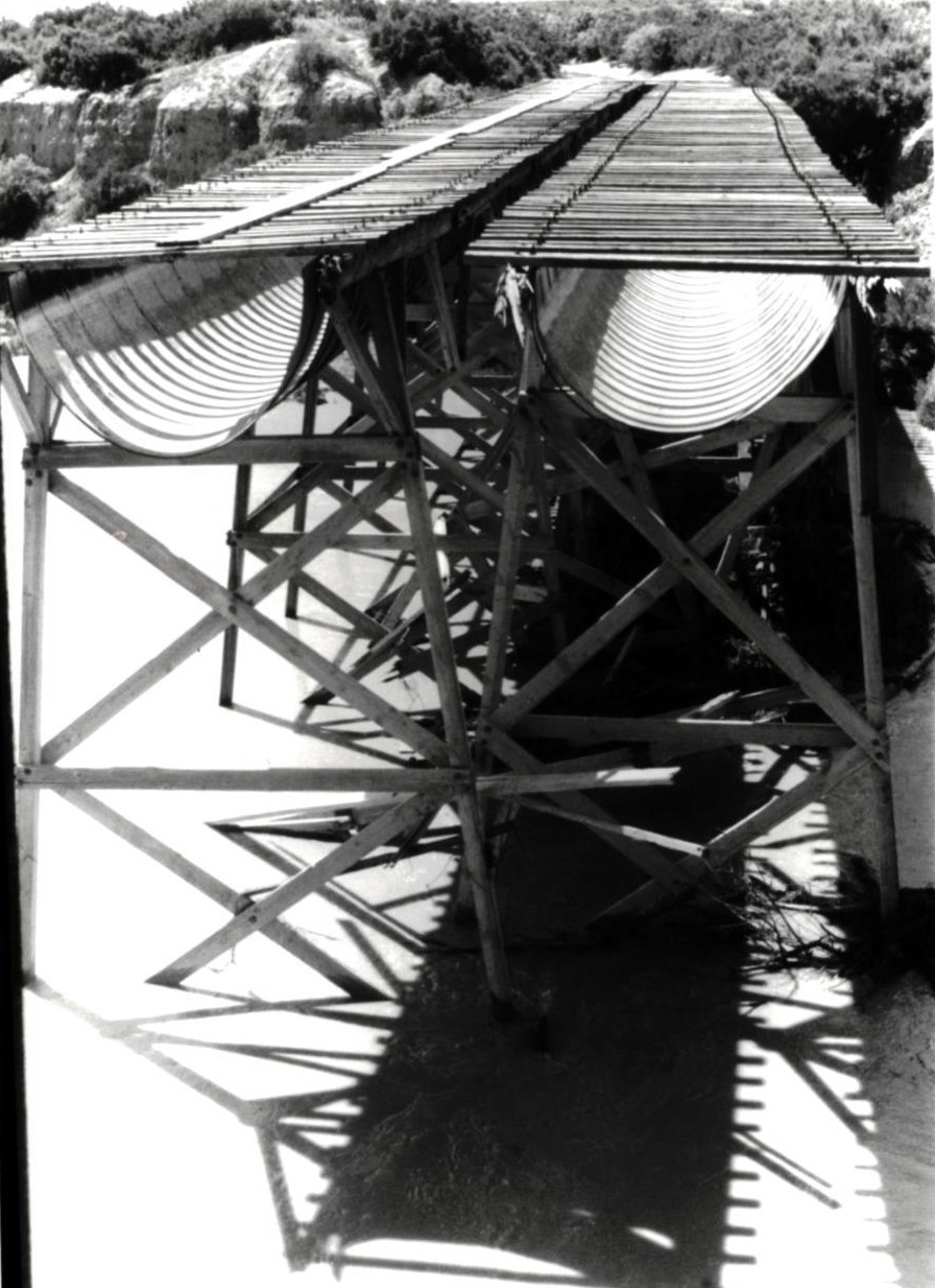
The flood washed out the bridge on US Highway 6 three miles below DMAD and overtopped the bridge on State Highway 257 in Deseret. The Union Pacific Railroad grade was severed near Riverside after floodwaters undermined the bridge. The historic flumes—twin wooden trestles carrying open irrigation canals across the Sevier River gorge constructed under the Delta Project—were struck by floating debris and torn in half. West Millard County, the primary agricultural base of 70,000 irrigated acres, was either submerged by or cut off from irrigation water.
Community Recovery and Replacement of the Failed Spillway
Reconstruction began immediately following the disaster. Restoring the irrigation infrastructure was critical to protecting the agricultural economy of west Millard County and safeguarding the industrial water supply for the Intermountain Power Project. Low-level outlet gates at Sevier Bridge Reservoir were closed on August 25, 1983, to dry up the lower 60 miles of river channel, allowing contractors to begin reconstruction efforts. Funding for reconstruction was secured through interest-free loans provided by the Utah Board of Water Resources, with engineering designs coordinated by state water resources engineers and consulting firms.
Gunnison Bend Dam was rebuilt with a multi-bay stoplog spillway that also supported a two-lane county bridge. The destroyed wooden flumes that delivered water to west Millard County were replaced with an enclosed pipeline resting on a new steel-trestle substructure.
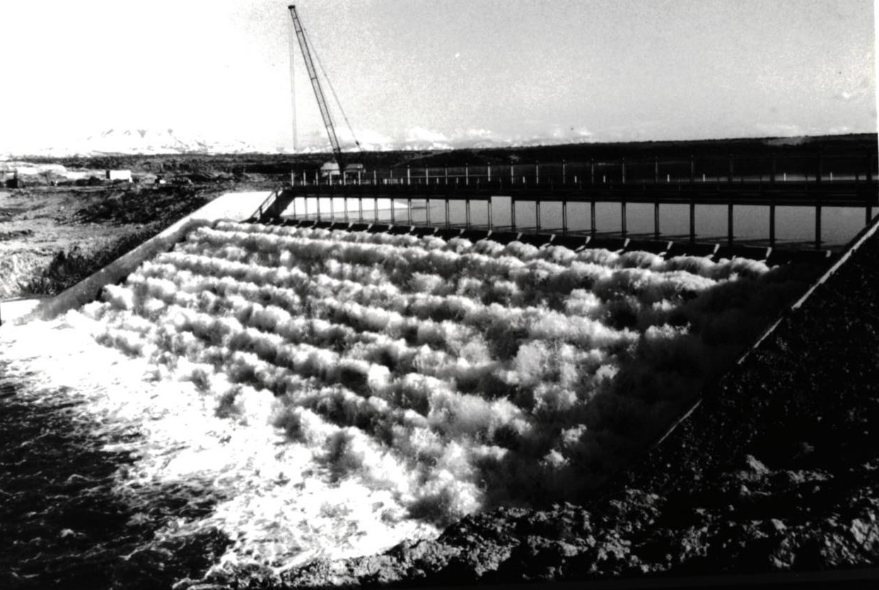
The 1984 replacement spillway for DMAD was designed by the Utah Division of Water Resources with a width of approximately 200 feet and included twenty-five 8-foot-wide stoplog bays equipped with 3 feet of stoplogs for upstream regulation. The spillway chute was designed with rows of 3-foot-high concrete baffle blocks down the apron to dissipate energy. Interestingly, the design included an upper row of baffle blocks across the spillway crest itself. Rather than passing the owner requested 3,000 cfs at elevation 4,666 feet, independent USGS flow measurements taken during the subsequent 1984 flood proved the structure could pass only 1,300 cfs, at that elevation. After a dispute between the owners and the engineers, the irrigation companies hired a concrete contractor to cut out the crest teeth to restore design discharge capacity. The drawings for the project indicate that these baffle blocks were “removed by owner 10/84”.
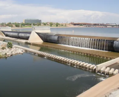
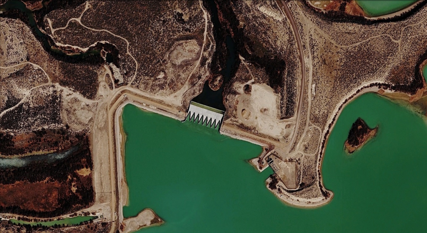
In 2022, the DMAD spillway built in 1984 was replaced by a new, labyrinth weir spillway. The replacement spillway addressed liquifiable soil under the previous spillway, meets the current probably maximum flood (PMF) requirements of the state, and other design standards updated after 1984. The spillway capacity is 48,300 cfs.
Lessons Learned
The failure of the DMAD spillway demonstrated the structural vulnerability of relying on an unmaintained, unarmored downstream drop structure, as well as the risks of operating an uncontrolled spillway without low-level regulating capacity.
Additionally, it shows the importance of reliable weather and runoff predictions and a willingness to operate reservoirs in accordance with those predictions.
It also highlighted the hazards of managing an interconnected river basin without centralized emergency coordination. In response to the disaster, the Utah State Legislature enacted legislation in 1984 granting the State Engineer emergency regulatory authority over river operations statewide, establishing a centralized chain of command during flood conditions.
Finally, the failure illustrates the importance of coordinated emergency response and communication. Despite the damage caused by the failure, no loss of life occurred.
References:
(2) Walker, W. (1997). Sevier River Flooding 1983-1984. International Water History Association.
(3) Sevier River Slows Assault on Dam. (1983, June 16). Salt Lake Tribune.
(4) Utah Dam Bursts, 500 Flee Flood. (June 24, 1983). Salt Lake Tribune. (Part 1 & Part 2)
This case study summary was peer-reviewed by Seth Thompson, P.E. (GFT).

Lessons Learned
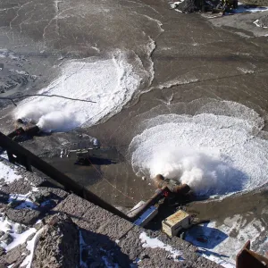
All dams need an operable means of drawing down the reservoir.
Learn more
Early Warning Systems can provide real-time information on the health of a dam, conditions during incidents, and advanced warning to evacuate ahead of dam failure flooding.
Learn more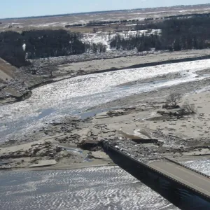
Forensic investigations are needed for major dam failures and incidents in order to determine the history of the contributing physical and human factors, and the culminating physical failure modes and mechanisms.
Learn more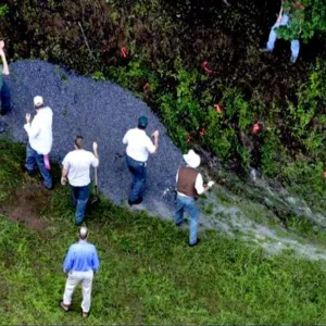
Intervention can stop or minimize consequences of a dam failure. Warning signs should not be ignored.
Learn more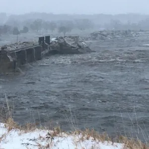
Past successful dam performance does not guarantee future successful performance.
Learn more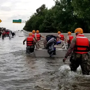
Timely warning and rapid public response are critical to saving lives during a dam emergency.
Learn more


Federal Guidelines for Dam Safety - Hazard Potential Classification System for Dams

A Guide to Public Alerts and Warnings for Dam and Levee Emergencies
Dams Sector Crisis Management Handbook

Stability Analysis of Concrete Structures, EM 1110-2-2100