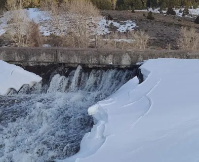
Fujinuma Dam (Japan, 2011)
Dam Description
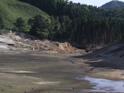
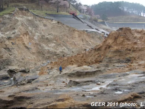
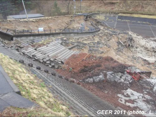
Fujinuma Dam was an 18.5 m (61 feet) tall and 133 m (436 feet) long earthen embankment dam with 1.5 Mm3 (1,215 acre-feet) of storage located in Sukagawa City, Fukushima Prefecture, Japan [3]. The downstream slope was 1:2.5 and the upstream varied from 1:1.5 near the crest to 1:2.8 in the lower section [3]. Construction began in 1937 but was halted during World War II. The dam was completed in 1949 prior to the implementation of national dam design standards in Japan [7]. It was built for offline storage of irrigation water and, therefore, not subject to the Rivers Act (1956), which regulates design standards for most dams in Japan [2]. Most post-failure analyses indicate the dam was “homogenous” [2,6] but with different quality materials used during various layers of construction. Design plans indicate a core section with inspection trench [5] and a possible remnant was noted by the GEER team during their reconnaissance that was more resistant to the overtopping erosion [1]. The three horizontal layers were sampled after the failure and in 1983 during investigation of a seepage problem [5,7,9]. The upper layer is characterized as 6 to 8 m thick coarse sand with N-value of between 2 to 3 with no indications of spreading or compaction. The middle layer was 7 to 9 m thick sandy silt with interbedded sand, silt, and clay and an N-value of 4. The lower layer was 4 to 6 m of mostly coarse to fine sand with silt and gravel and an N-value of 4 [7]. Spreading lifts were evident every 20 to 45 cm in the middle and lower layers [1]. The foundation appeared to have not been adequately grubbed or stripped, containing a 1 to 2 m layer of black, organic rich, clayey silt with logs and even a tree stump [1,3,5].
Earthquake
On March 11, 2011, a M9.1 earthquake occurred in the Pacific Ocean east of Japan. The dam is located about 102 km from the closest section of the earthquake rupture zone (and 75 km from the coast). Nearby seismographs at 2.8 km and 12 km distance from the dam indicated peak ground accelerations of 0.32g and 0.34g, respectively [5]. Strong shaking lasted for about 100 seconds with large accelerations having a frequency from 0.1 to 1 second [2].
Failure
The reservoir was nearly full when the earthquake occurred [2]. No one was there when the failure initiated, but overtopping of the lowered crest was observed a few minutes later. The likely failure mode was a seismically induced slope failure in the upstream direction that lowered the crest below the reservoir water level, allowing it to overtop and breach the remaining, weakened dam body. Evidence of multiple slides was observed, but all direct evidence of the slide that likely triggered the overtopping was washed away [7]. Multiple dynamic stability analyses of the dam show large possible slip surfaces with low factors of safety [5, 6, 8, 9]. No evidence of liquefaction was observed, and no liquefiable soils were noted in the remnants of the dam or foundation [1,8]
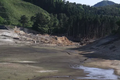
Downstream Impacts
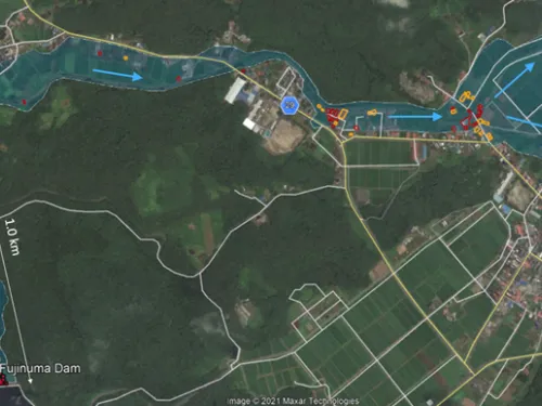
Below the failed dam, the flood rushed down the heavily wooded canyon toward the towns of Taki-syuraku and Sukagawa. Survivors recalled that the flood came in two waves. The first following a loud crashing sound and the second about 10 minutes later [3,9]. Some people returned home to fetch belongings and were caught by the second wave [3]. Eight people were killed in Taki-syuraku [1,2,3,4] where the damage was most severe as the flood exited the narrow canyon and made a sharp right turn into a larger river. The armored river channel and bridges were badly damaged or destroyed for another 2 km downstream. Property damages were estimated to include 19 destroyed homes, 32 with significant flood damage, and 30 with minor flood damage in addition to public and commercial property [12]. Based on the average household size for Sukagawa City in the 2010 census, the population at risk (PAR) was estimated as 306, resulting in a fatality rate of 2.6% of PAR [12].
Repair
The dam was redesigned to withstand earthquake loading and rebuilt from 2013 to 2017 [11]. The new dam required deeper excavation to competent bedrock and includes a core with upstream and downstream filters and buttresses [10, 11].
References
(5) Harder, L. (2012). Update on the Failure of Fujinuma Dam following the March 11, 2011 Tohoku Offshore Earthquake, Japan. 2012 [Presentation]. ASDSO 2012 Annual Conference. Association of State Dam Safety Officials.
(10) Watanabe, T., & Watanabe, H. (2015). Breach Factors and Restoration Method of Construction of the Fujinuma Dam. J Water Land and Environment Engineering (in Japanese).
(11) The Japan Dam Association. (2017). Fujinuma Dam Construction Work Tour.
This case study summary was peer-reviewed by Lee Wooten, P.E., GEI Consultants, Inc.
Lessons Learned

Dam failure sites offer an important opportunity for education and memorialization.
Learn more
Dam incidents and failures can fundamentally be attributed to human factors.
Learn more
Dams located in seismic areas should be evaluated for liquefaction, cracking, potential fault offsets, deformations, and settlement due to seismic loading.
Learn more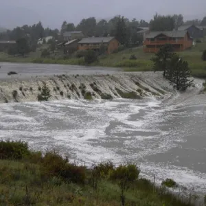
Dozens of dams can fail or be in danger of failing during a single event (i.e. swarming failures). Dam owners and regulators need to prepare for these types of events.
Learn more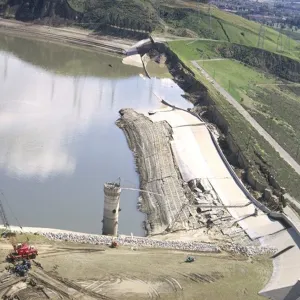
Stability of the dam foundation and other geologic features must be considered during dam design.
Learn more
Federal Guidelines for Dam Safety - Earthquake Analyses and Design of Dams

Federal Guidelines for Dam Safety - Hazard Potential Classification System for Dams

