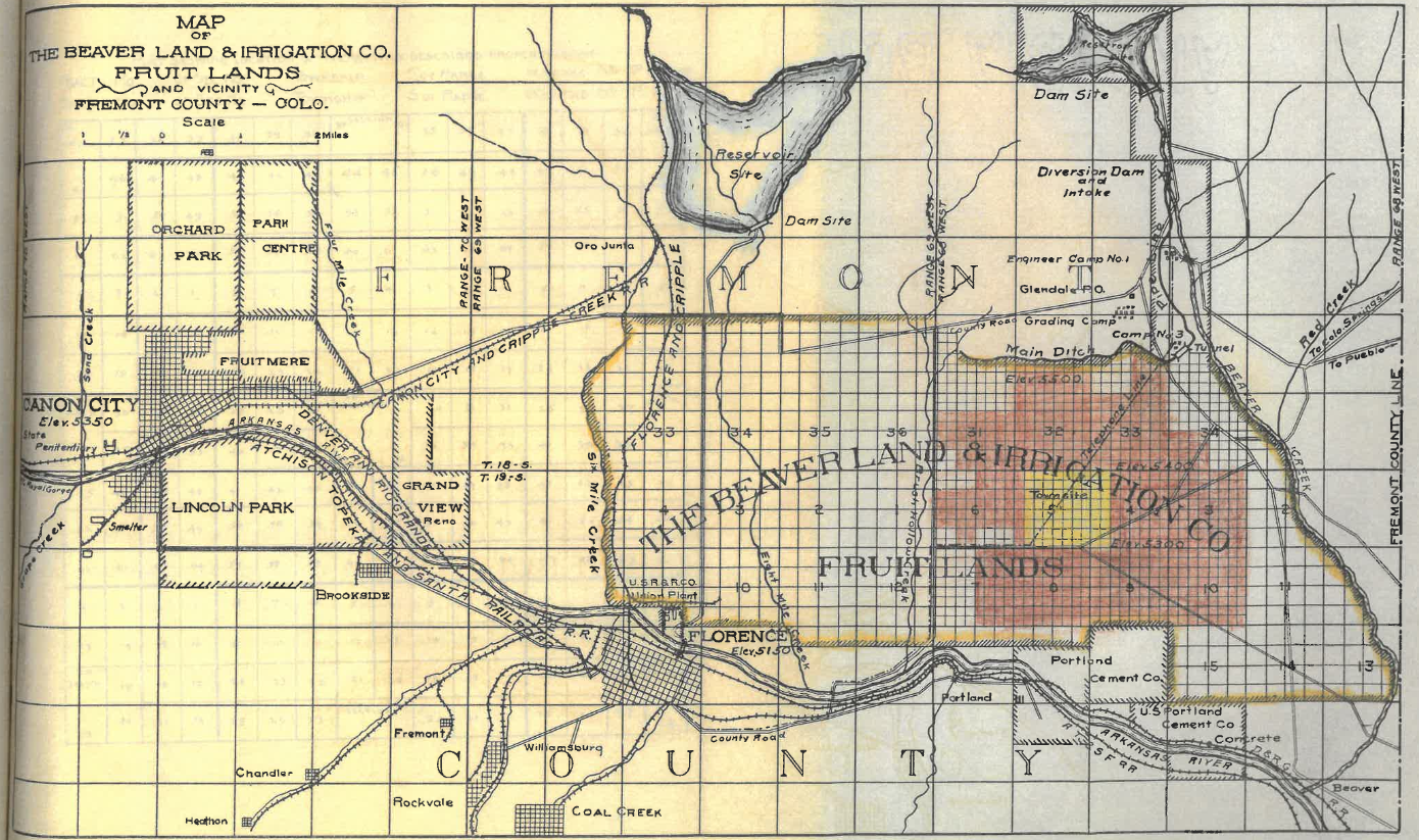
The Town of Penrose
Pioneers began settling in present-day Penrose in the early 1860’s. The Town of Penrose, Colorado is upstream of the confluence of Beaver Creek and the Arkansas River, located 25 miles west of Pueblo. Settlements began along the banks of Beaver Creek. The gold-rich entrepreneur, Spencer Penrose saw a business opportunity and formed the Beaver Land and Irrigation Company. He planned to develop the area into a lively town of agriculture and trade. His plans included Schaeffer Dam, three other dams west of Schaeffer Dam, a 722-acre platted town (present-day Penrose), railroad transportation for produce and passengers, and irrigation ditches to support cattle and farms. While not all of Penrose’s plans were completed, the construction of Schaeffer Dam was completed in 1909 [3].
As part of bringing vitality to the arid west, water storage has been paramount for settlers in southern Colorado. To help the settlers and farmers along Beaver Creek, the Shaeffer Dam and Reservoir was constructed. Schaeffer Reservoir (also known as Lake McNeil) supplied irrigation to over 3,000 acres of farmland. With the water supplied by Schaeffer Dam, the community of Penrose grew to be the largest fruit growing district in the State of Colorado.
The Schaeffer Dam was originally called the Beaver Creek Dam and Reservoir. Planning for this dam began in 1907 by the Beaver Land and Irrigation Company, which was formed and backed by a group of investors from Colorado Springs. The investors included Spencer Penrose and Charles McNeil. The dam was renamed Schaeffer Dam, and the reservoir was named Lake McNeil after Charles. Recreation at Lake McNeil included fishing, wagon rides, and picnics [3].

Construction of Schaeffer Dam
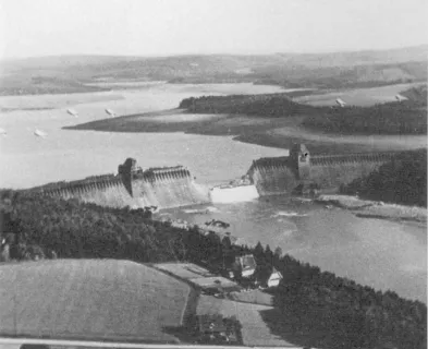
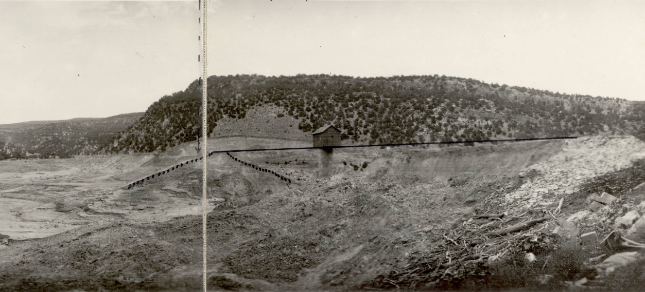
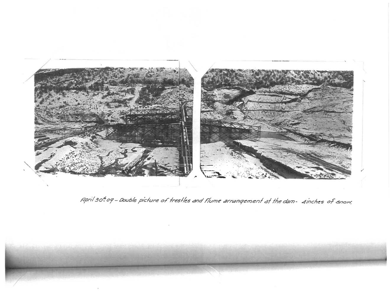
Shaeffer Dam was constructed from 1908 to 1910 in Fremont County, Colorado. The dam was 100 feet tall, 1,100 feet long, had a 15-foot-wide top width, and had a storage capacity of 3,190 acre-feet. The dam had a 3H:1V upstream and 2H:1V downstream slopes. The dam also had a 100-foot-wide spillway with 10 feet of freeboard [2].
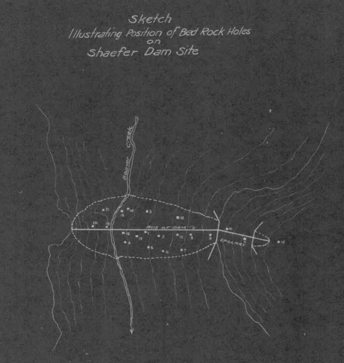
The dam site geology consisted of bedrock, overlain with 6 to 12 feet of cobbles and gravels, overlain with clay. Three cutoff trenches were dug up to two feet into bedrock along the length of the dam. The center cutoff trench extended toward the west, where the contractor tunneled 115 feet to remove the gravel lens between the bedrock and overlying clay. The tunnel was backfilled with concrete. A cutoff wall consisting of wood plank, burlap, and asphaltum was constructed on top of the center cutoff trench. Concrete was placed on the upstream and downstream sides of the plank cutoff wall to tie it into the bedrock foundation. The upstream and downstream cutoff trenches were filled with the puddling of clay via hydraulic process [7].
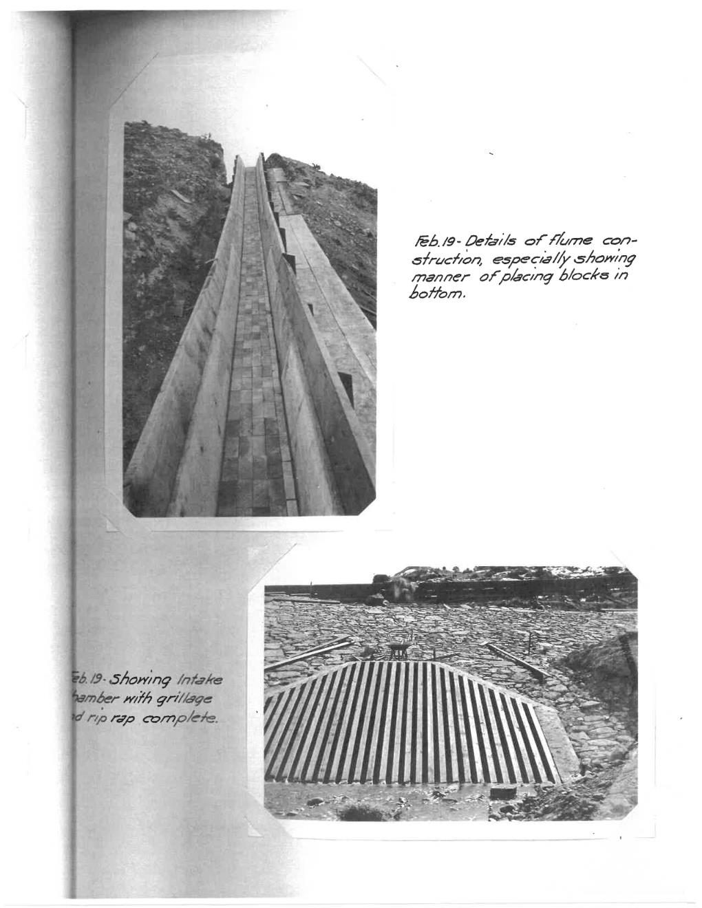
The outlet works consisted of a 4-foot by 5-foot concrete arched culvert that was controlled by a set of double gates set in a masonry control tower. The contractor placed stones on the outside of the arched culvert to aid in fill material bonding and to reduce the likelihood that seepage paths would form along the outside of the culvert. The intake consisted of a structure with wing walls and a trash rack. The outtake was a similar wing wall structure without a trash rack.
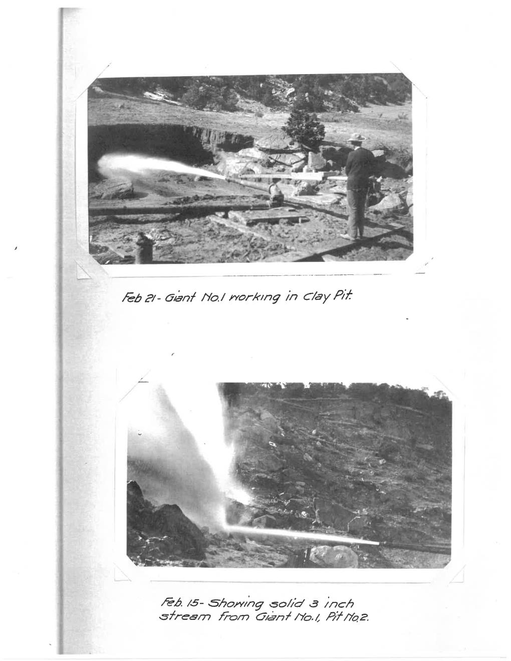
The dam was constructed using the hydraulic fill method, which was common in dam construction at the time. The chief engineer of the dam reported that the conditions of the site were ideal for hydraulic fill. The cobble, sand, and clay borrow areas were located a half mile upstream. Water from 7 miles upstream of the dam could be used to jet borrow material and sluice it towards the dam. In the monthly progress reports [7] the engineer states: "Take it altogether, probably it would be difficult to find conditions and materials more favorably placed by nature for an hydraulic fill than those closely adjacent to the Shaefer site." And later states: “There is no known method of more efficiently consolidating an earthen embankment, providing the right proportion of materials can be obtained, and providing the methods employed are such as to produce the proper gradation of said materials..."
The chief engineer describes the hydraulic fill method as such:
"In the very nature of the sluicing process where the banks attacked by the hydraulic jet bring down masses of clay, boulders, gravel and sand, and conduct these materials with great velocity through sluices laid on high percentage grades (usually 8 feet per hundred) and distribute the mass along the external toe of the slope of the dam, the heavy materials remain were dumped while the lighter portions grade toward the center of the dam in the order of their specific gravity. This hydro gradation of materials results in the central portion of the dam becoming a homogeneous mass of an impervious nature, largely clay where clay exists in the embankment washed down, and from the center outwardly, the coarser particles grade naturally in the order of their weight; thus the exterior slope consisting of boulders and rock, acts as a drainage agent to the wet semi-plastic interior, and at the same time affords stability to hold it in place, until complete drainage by percolation has occurred."
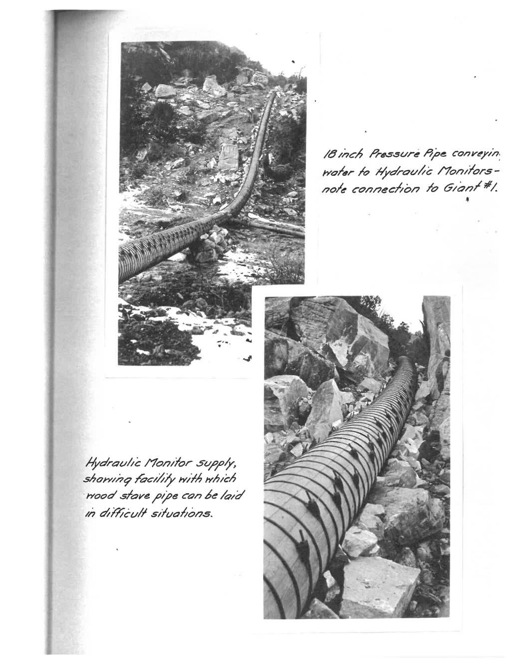
The water was taken from Beaver Creek 7 miles upstream of the dam, and conveyed through cement-lined ditches, pipe and wood stave pipe to the borrow area. The wood stave pipe served as a pressurized section that ended at the two giants (or jets) used to remove the cobble, gravel and sand borrow or the clay borrow, respectively. The system conveyed a combined 10 cubic feet per second to the two giants at a pressure of over 100 psi. Cuttings and water were then directed through sluices at an 8 percent grade to the dam site and deposited at the upstream and downstream toes as explained in the chief engineer’s description.
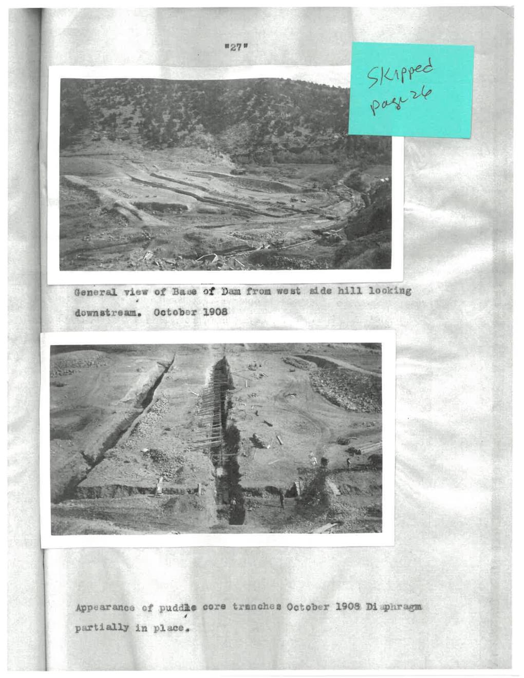
The puddled core was reported as being more liquid than solid and was not consolidating. Therefore, the hydraulic fill method was abandoned after the dam was about 30 feet tall. The liquid core was said to be removed and replaced by dry earth. The dam was finished by fill being deposited by wagons, sprinkling and rolling in thin layers [2].
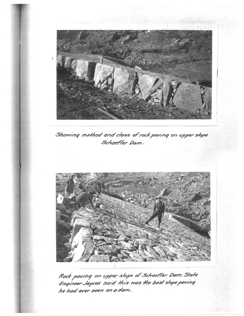
Riprap was hand placed on the upstream and part of the downstream slopes using wooden sluices, some lined with bricks. The sluices were reported to convey rock up to 150 lbs, which equates to about a 12” rock. The spillway was constructed east of the dam and flows directed away from the downstream toe of the dam via a canal. The chief engineer mentioned the spillway to have a capacity of 5,000 cfs. In 1908, when the dam was being designed and constructed, the greatest known (record) flood on Beaver Creek was 1,000 cfs. The spillway design had a factor of safety of 5 applied to the flow [7]. The USGS report classified the June 2-5, 1921 storm event (which ultimately overtopped the dam leading to failure) as a 10,000-year storm [2]. USGS StreamStats shows the dam’s drainage area to be 137 square miles and the 100-year event peak flow to be 1,540 cfs [9]. The Colorado Department of Water Resources’ flood database shows that the PMP could be on the magnitude of 30,000 cfs [10].
The Great Flood of 1921
From June 2-5, 1921, heavy rains in the foothills of the Arkansas Valley in Colorado caused one of the most severe floods in the interior Unites States even prior to the dam failure. The flooding was the result of a series of “cloud-bursts.” USGS describe the phenomena called cloud-bursts as “very intense rainfalls of short duration over small areas that are sharply defined. Cloud-bursts are common along the eastern slope of the Rocky Mountains wherever canyons have cut deeply into the mountain masses. Each of these canyons acts like a chimney flue in creating a strong upward draft for the warm and relatively moist air from the plains, which passes up the canyon and reaches an altitude where the temperature becomes low enough to condense the moisture. The upward draft is sufficiently strong to support the moisture for some time after condensation begins, but finally the weight of moisture in the air becomes too great to be longer sustained and it is precipitated in torrents [2].”
The USGS reports that weather stations recorded precipitation depths up to 5 inches. However, the heaviest precipitation of the storm was isolated and in regions where stations are not maintained. The USGS relied on interviews with local residents to get an idea of the precipitation magnitude. These unofficial rainfall totals by civilians were as high as 10 to 14 inches in some areas. Upstream of Schaeffer Dam, reports suggested 7 inches of precipitation in 12 hours, rainfall on the magnitude of a 10,000-year event according to the Colorado-New Mexico Regional Extreme Precipitation Study (CO-NM REPS) [10]. The torrents of rain can cause a “wall of water” rushing down the streams and rivers. The initial rain, as it collects in a watercourse, is slowed by friction. The rain that fell first is eventually overtaken by rain that may have fell minutes later. Water can continue to compound in this way until the flood moving rapidly down the watercourse is fronted by a wall of water than can be several feet deep. In the case of the 1921 flood, water in the Arkansas River and nearby streams had a rapid rise, and shortly following, a rapid fall in flow depth [2].
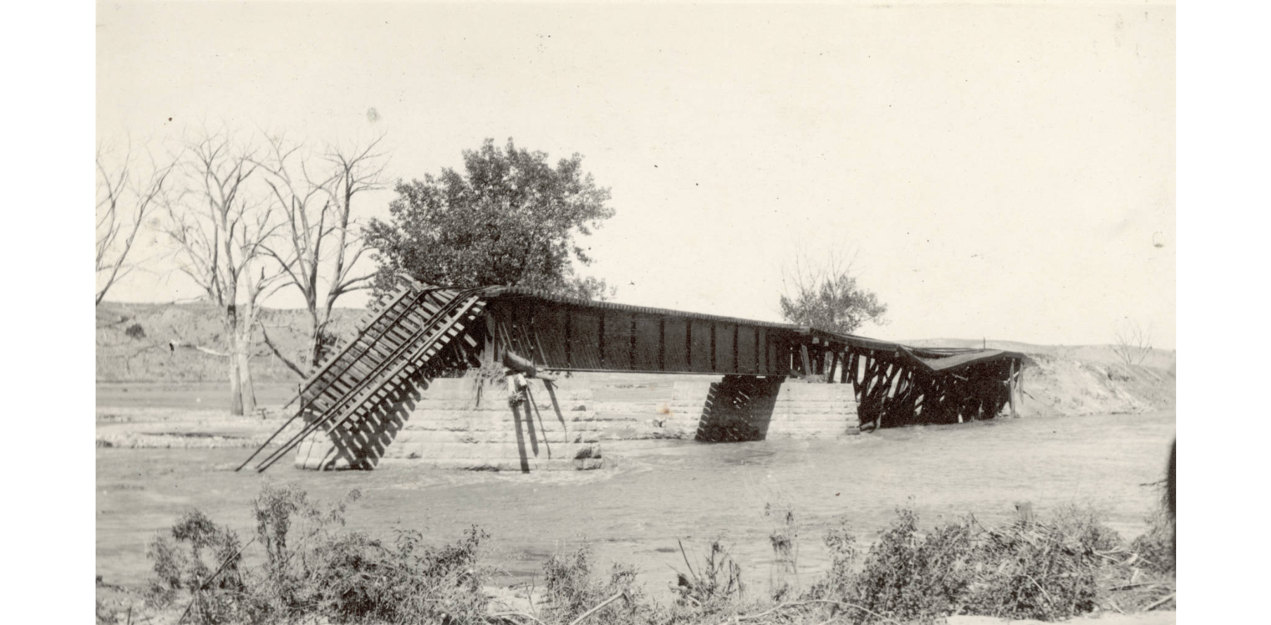
Most of the loss of life and damages from the flood occurred in Pueblo and surrounding areas on June 3, which was the first day of flooding and when the Arkansas River was at its highest flood stage. Heavy rain was reported ten miles west of Pueblo with warnings of future flooding. Around midnight, the Arkansas River reached its peak flow of 108,000 cfs as it flooded Pueblo. Some buildings in the downtown area were inundated with 15 feet of water. The total volume of water flowing through Pueblo from the June 2-5 storms is estimated to be approximately 90,000 acre-feet.
The death toll from the Great Flood of 1921 is estimated to be 150 to 250 fatalities. Some believe there were more, even over 1,500 fatalities. The death toll was difficult to know because several people were missing and likely washed miles downstream. Also, in 1921, people of minor demographics were not always accounted for, and there were several immigrants traveling through the area that were staying temporarily. Bodies of those killed by the flood were found as late as 1929 when a body was found at a location 40 miles east of town. The flood had inundated 300 square miles. More than 500 houses were carried away, along with 98 businesses or industrial buildings, 61 stores, 46 locomotives, and 1,274 railroad cars. Telephone lines were destroyed, so there was little to no communication between Pueblo and the rest of the state. Decomposing bodies of livestock littered the valley. The flood’s total damage of around $20-25 million, is the equivalent of about $350-440 million in 2024. Half of the damages occurred in the City of Pueblo. Railroads saw the greatest damages. Six of seven bridges were destroyed, and help by rail could not reach the flooded areas until two days after the flood [2,5,6,8].
Walt Drummond describes the devastation of the flooding in Pueblo in a poem printed in the Pueblo Chieftain on June 17, 1921 [1]. A section of the poem reads:
“Clouds burst asunder and a deluge came. Twas thus that Nature in her maddest mood Sent down the raging waters of the flood To scourge the fertile valleys of the plain, And fair Pueblo man had builded there, Was crushed and maimed, now prostrate bleeding lies.”
Three dams were impacted by the June 2-5, 2021 flood event: Schaeffer Dam on Beaver Creek, Skaguay Dam on Beaver Creek upstream of Schaeffer Dam, and Teller Dam on Turkey Creek. To a slight degree, the three reservoirs helped reduce flooding by holding back flood water (prior to the failure of Schaeffer Dam). The Skaguay and Teller dams safely withstood the flood without failing. However, the Schaeffer Dam was not so fortunate.
Dam Failure
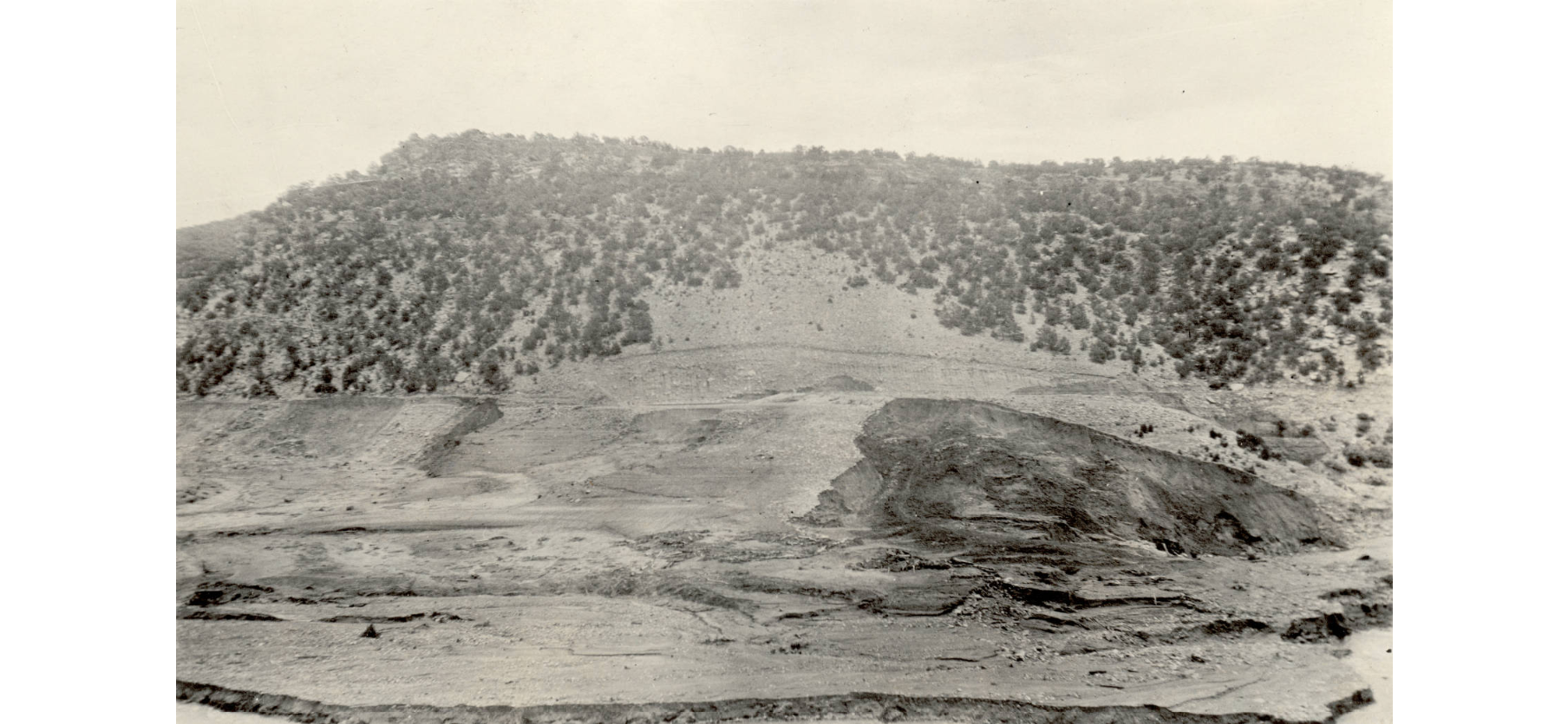
At Schaeffer Dam, the storm began around 7 p.m. on June 3, at which time the reservoir was 7 feet below the spillway level. By 4:30 a.m. on June 4 the reservoir had filled and the spillway began spilling water. At 7:30 a.m. on June 4, the spillway was recorded flowing 1,500 cfs, with additional flow exiting through the outlet works. From then, the reservoir began to recede, with the peak of the flood seeming to have passed. However, at 7:30 p.m. on June 4, the reservoir began to rise again, continuing at a rate of 3 inches per hour. On the morning of June 5, flows in Beaver Creek seemed to surge and overtopped the dam for 75 feet along the dam crest in the middle section. The dam failed shortly after [2].
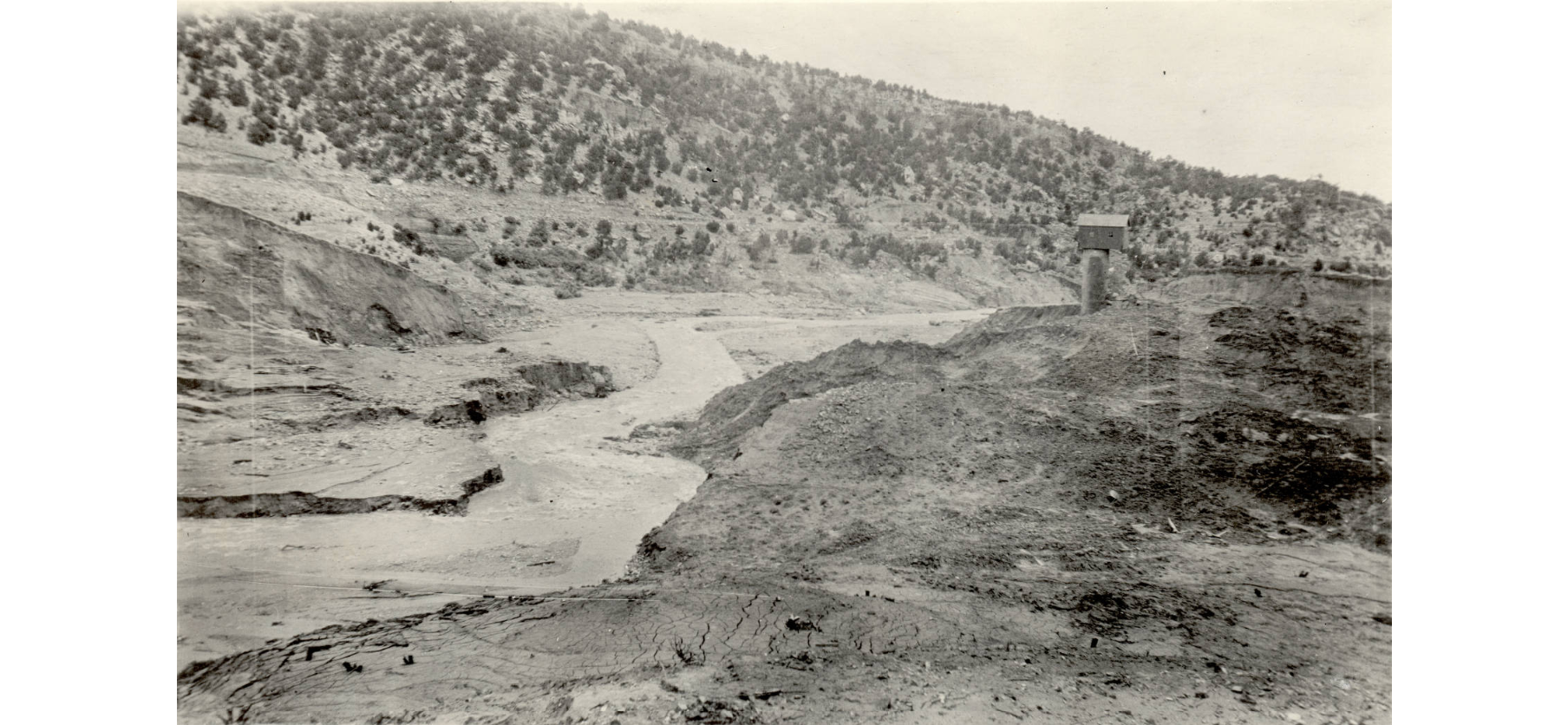
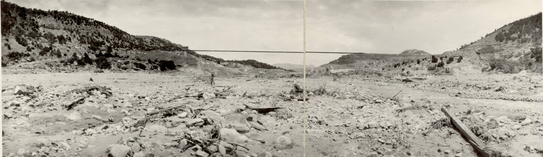
The failure of the dam drained the entire reservoir (3,600 acre-feet) in approximately 30 minutes and released a wall of water that removed every tree, house, and object in its path and contributed to the flooding in Pueblo 34 miles away. The resulting flood wave from the failure was estimated at 153,000 cfs, a big change from the 30 cfs normally seen in Beaver Creek. The average velocity of the flood wave was 7 mph (10 feet/second). The resulting breach in the dam consisted of a 500-foott top width and a 300-foot bottom width. Since the dam breach occurred on June 5 (after the main flooding on the Arkansas River) the community was on alert and no lives were lost due to the breach [2].
The flood wave washed away fertile topsoil, and most families did not return to their homesteads. Damage totals that are directly related the failure of Schaeffer Dam are difficult to determine. The damages as a direct result of the failure likely span to where Turkey Creek flows into the Arkansas River. The flood wave caused damage along 10 miles of Beaver Creek and 11 miles the Arkansas River. The sharply peaking flood wave quickly flattened, lessening to flows much less than the peak flow experience in Pueblo on June 3. Beyond Turkey Creek, the flood stage was higher on June 3 [2].

Physical contributing factors to the failure of Schaeffer dam include the following:
- The dam crest was not a consistent elevation, potentially being a result of settling of the dam. USGS says that its average height of the dam was 90 feet in the center 500 feet of the dam. The dam tender reported that initial dam overtopping occurred along a 75-foot length in the middle of the dam. This caused a concentration of flow when the dam was overtopped, resulting in greater erosion.
- The Schaeffer Dam spillway was undersized. The contributing basin experienced an extreme storm event on the magnitude of a 10,000-year storm event. The spillway was not able to handle the resulting flows in Beaver Creek, resulting in the dam overtopping and failing.
- The dam seems to have been constructed with highly erodible material and had poor vegetation cover, both of which may have contributed to the rapid failure after overtopping occurred.
Human contributing factors to the failure of Schaeffer Dam include the following:
- While the Skaguay Dam was able to pass the storm event without failing, the dam was not unscathed. Water ran over the dam in low places during the flood. In an effort to stop these overtopping flows and save the dam, the dam tenants used dynamite to blow out flashboards in the spillway, resulting in a sudden release of water through the spillway. This surge of water from the Skaguay Dam caused damage to pipes in the channel downstream [2]. While not confirmed, one could speculate that this sudden release of water may have been the surge that Schaeffer Dam experienced on the morning of June 5. However, there are other natural causes, such as a debris dam failure or flash flooding that can cause surges of water during extreme flooding events.
- The construction of Schaeffer Dam was pressured by cost and schedule constraints. The Beaver Land and Irrigation Company had a limited budget they could spend on the dam while still profiting from the farm land and water sold as a whole. The irrigation company had a difficult time selling the plots of farm land in Penrose until the construction of the dam was underway. Farmers wanted to know that a viable water source was being procured before making a purchase. As land was purchased, the irrigation company was racing to secure Schaeffer Dam so that spring runoff could be stored. Without the reservoir, the Penrose farmland had the potential to be shorted water later in the year or in early spring when the creek still froze during nights.
- The Beaver Land and Irrigation Company was concerned with securing water rights in other basins. Schaeffer Dam needed to be completed so that other projects (and dams) could be designed and constructed.
- The natural human response during floods is to move to high ground. This response combined with the flooding on June 3-4 likely saved lives during the dam failure.

Lasting Effects
The fruit production in community of Penrose Colorado was essentially lost due to the loss of soil and property and is still in recovery to this day. Spencer Penrose’s railroad wasn’t making money, town lots weren’t selling, and he had lost Schaeffer Dam. He considered his investments and efforts to develop the Beaver Creek area as a failure. He turned his attention toward other money-making interests, such as the Broadmoor hotel in Colorado Springs.
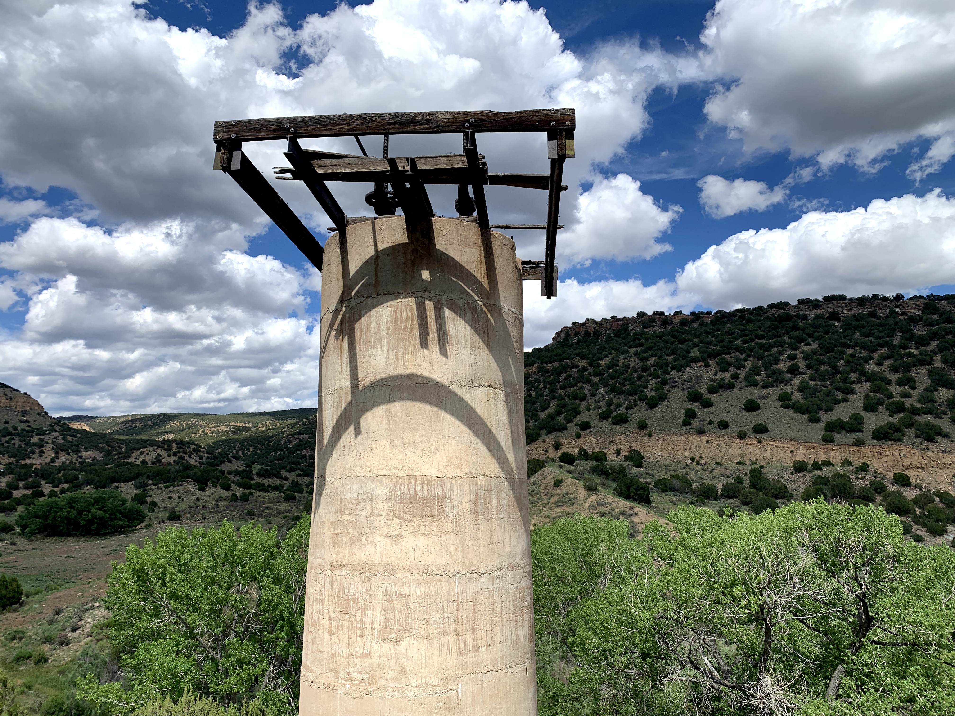
The dam was not reconstructed following the failure. The breached embankment is still standing along with the gate tower and even some of the abandoned construction equipment. Access to the site is on private property and landowner permission should be obtained. To supplement the water that was lost, the ditch company constructed Brush Hollow Dam. The community of Penrose, Colorado still exists and continues to produce fruit, but not on the scale prior to the flood. Beaver Creek still supplies the Town of Penrose with water for their crops. Information including the construction documents and daily reports are located at the Penrose community library [7].
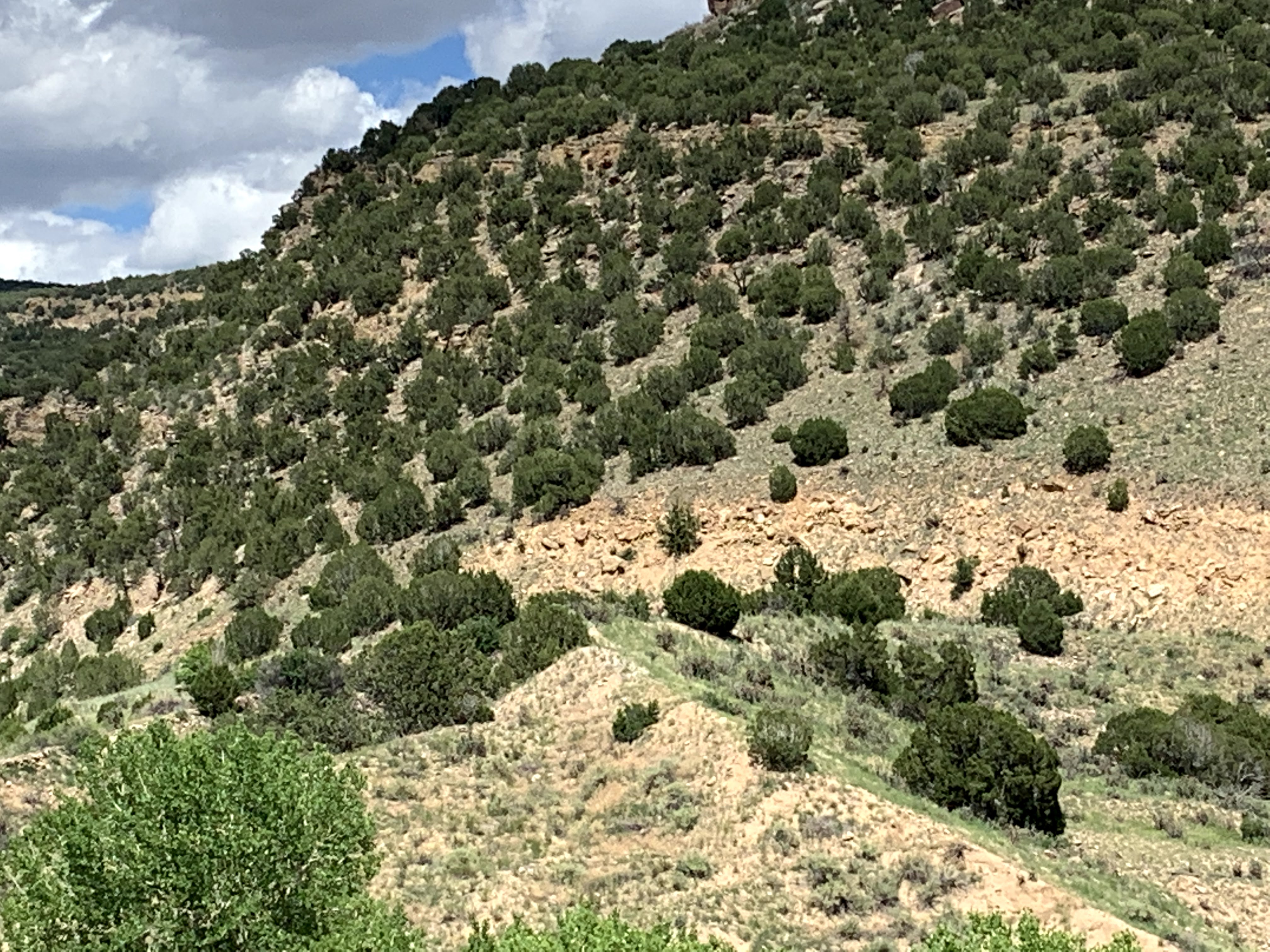
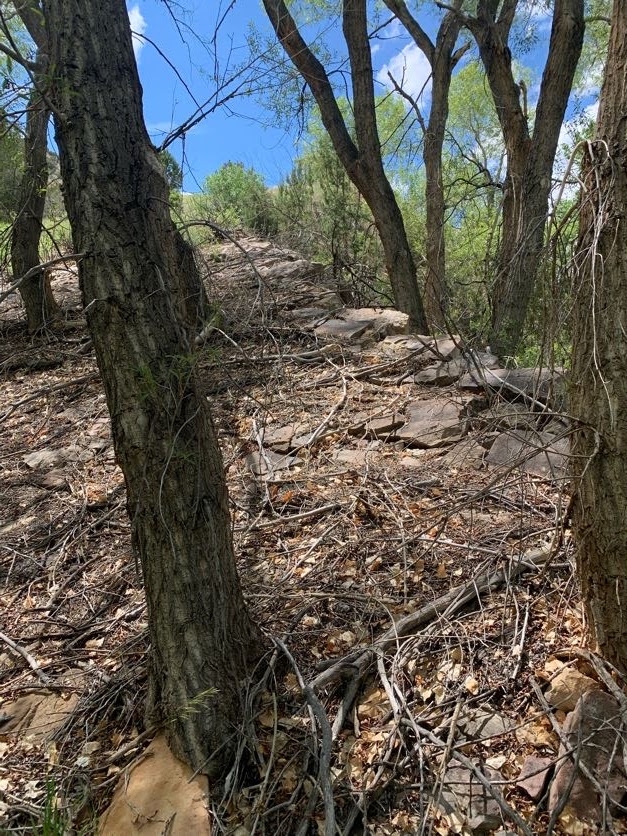
Today there is a 1.3-mile hiking trail referred to as the Schaeffer Dam Loop (BLM#6102K) that provides scenic views of Patton Canyon, Beaver Creek, and the historic Schaeffer Dam site. Ruins from the dam failure, including the dam’s control tower, are visible from the trail [4].
Pueblo constructed a new Rock Creek flood control dam on the Arkansas following the 1921 flood. This dam was later replaced by the much larger Pueblo Dam. The United States Bureau of Reclamation's Pueblo Dam impounds Lake Pueblo, which among other water uses provides a means of flood control for Pueblo.
References
(1) Drummond, W. (1921, June 17). Pueblo Chieftain [Poem]. The Franklin Press.
(2) Follansbee, R. & Jones, E. (1922). The Arkansas River Flood of June 3–5, 1921. US Geological Survey. Government Printing Office.
(3) Johns, S. (2010). Penrose History.
(5) Rocky Mountain PBS. (2021). Colorado Experience: The Great Pueblo Flood.
(7) The Beaver Land and Irrigation Co. (1907-1909). Monthly Reports July. Digital copies provided by Penrose Community Library.
(8) The History Guy. (2021). Pueblo Colorado: The Great Flood of 1921 [Video]. YouTube.
(9) U.S. Geological Survey. (2024). StreamStats v4.20.1.
(10) Department of Water Resources. (2022). Guidelines for Hydrologic Modeling and Flood Analysis. State of Colorado, Department of Natural Resources.
This case study summary was peer-reviewed by Clint Brown, Engineering Analytics, Inc. and Mark Perry, Dam Safety Engineer, Colorado.


Lessons Learned

Extreme floods do occur.
Learn more
High and significant hazard dams should be designed to pass an appropriate design flood. Dams constructed prior to the availability of extreme rainfall data should be assessed to make sure they have adequate spillway capacity.
Learn moreAdditional Lessons Learned (Not Yet Developed)
- Dam failures can have lasting physical and economic impacts.
- The dam crest should be a consistent elevation.
- Inadequate material should be removed and replaced during construction.
- Flooding can be unpredictable. The evidence of the incoming flows decreasing does not always mean the peak flow has passed.

Dam Safety Rules (2CCR-402-1)

Guidelines for Early Warning System Programs