Lake setting and the early agricultural levees
Lake Okeechobee is a large, shallow, natural freshwater lake at the center of the South Florida water-management system. The lake was not created by constructing a dam across a stream or river. It has a surface area of approximately 730 square miles of a fairly uniform shape with fetches of approximately 35 miles running north to south and 28 miles running east to west. The lake has an average depth of only about nine feet, and a current drainage basin definition of approximately 4,400 square miles including the lake proper. Two of these physical factors combined to produce the high water: Hurricane winds acting over a long fetch and the shallow basin allowing the water surface to tilt substantially from one side of the lake to the other (South Florida Water Management District, undated).
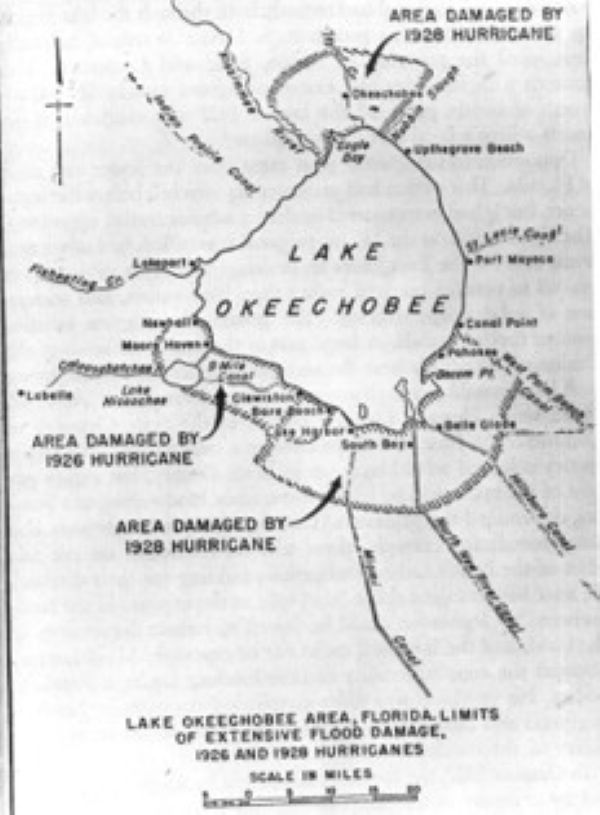
During the early twentieth century, public and private parties were draining and developing lands around the lake for agriculture and settlement. Local interests constructed discontinuous earth embankments from available sand and muck beginning around 1915. These embankments were true levees along the shoreline of a natural lake, not dams built across a stream to create a reservoir. Their purpose was to exclude lake water so adjacent marshlands could be drained and reclaimed for agriculture and development. Generally only about 4 to 5 feet high, they were not engineered to resist an extreme hurricane. Communities including Moore Haven, Clewiston, South Bay, Belle Glade, Chosen, Pahokee, and Canal Point developed beside or immediately downstream of the low embankments. The levees reduced frequent nuisance flooding and made development appear more secure, but they did not remove the lake’s wind-wave hazard (USACE, 2025; Weather Forecast Office, Miami, n.d.).
The 1926 Hurricane: A Warning at Moore Haven
The Great Miami Hurricane made landfall in South Florida as a Category 4 storm on September 18, 1926, and crossed the peninsula toward Lake Okeechobee. Strong northerly winds drove lake water toward the south and southwest shore. U.S. Weather Bureau Technical Paper No. 48 reports that the water piled up to approximately 10 feet above the pre-storm lake level on the south side, topping the levees near Moore Haven and causing extensive flooding and loss of life south of the lake (Harris, 1963; Weather Forecast Office, Miami, n.d.).
More than 100 people were killed around Moore Haven. The 1926 inundation was smaller than the disaster that followed two years later, but it exposed the same basic failure mechanism: a shallow lake, a long effective fetch, hurricane-force winds, minimal freeboard, erodible embankment materials, and developed land lying immediately downstream. The incident was a direct warning that the local levees could not safely contain the lake during a major hurricane.
After the 1926 event, the available records show only a partial repair, but not a meaningful upgrade. The 1929 federal report states that the damage had not been fully repaired by the spring of 1927. The U.S. Court of Claims later found that the washed-out portions were subsequently repaired to their original state before the 1928 hurricane. No source reviewed indicates that those repairs materially raised or strengthened the levee. The Everglades Engineering Board of Review had recommended incorporating the existing embankment into a levee with a top elevation of 27 feet, about 5 feet higher than the old levee, but the 1929 report described the old levee after the 1928 storm as still standing practically as it was before and concluded that it had not proven sufficiently high or strong during either hurricane. After the 1928 disaster, federal engineers called for a higher levee with a heavier cross section and more thorough riprap protection (Chief of Engineers, 1929; Creech v. United States, 1945).
The 1928 hurricane: Catastrophic Overtopping and Breach
The Okeechobee Hurricane came ashore near Palm Beach during the evening of September 16, 1928, as a Category 4 storm and moved west-northwest across South Florida. The lake was already high following a wet summer. As the hurricane crossed the region, sustained winds pushed the lake surface toward the south and southeast shores and generated large waves. The wind setup raised the mean water level at the levee while individual waves and wave runup repeatedly reached higher. The combined water surface exceeded the crest of the embankments at multiple locations (Weather Forecast Office, Miami, n.d.; Lloyd’s Emerging Risks Team, 2007).
Once overtopping began, the embankments had little capacity to resist continued attack. They were low, locally constructed, and composed of sand and muck. They did not have a modern filter and drainage system, erosion-resistant crest, or engineered slope protection. Water flowing across the crest and down the landward face eroded the earthfill, while waves continued to attack the upstream slope. Several breaches developed, allowing the lake to discharge into the low agricultural lands beyond the levees.
The catastrophic lakeside flooding was not documented as coastal storm surge propagating into Lake Okeechobee but as wind setup and wave action acting on the levee embankments. Heavy rain and the high antecedent lake level increased the available water and reduced remaining freeboard, but the immediate loading at the failed levees was primarily wind setup and wave action generated on the lake itself. Wind setup raised the stillwater level; waves and runup were superimposed on that raised surface; overtopping then initiated erosion and eventual breach.
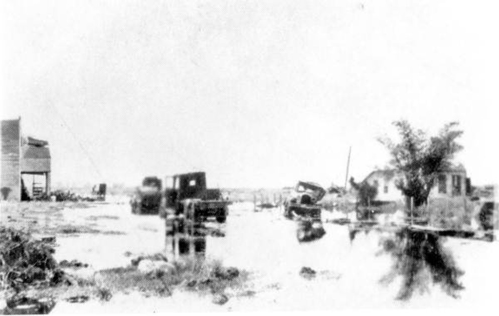
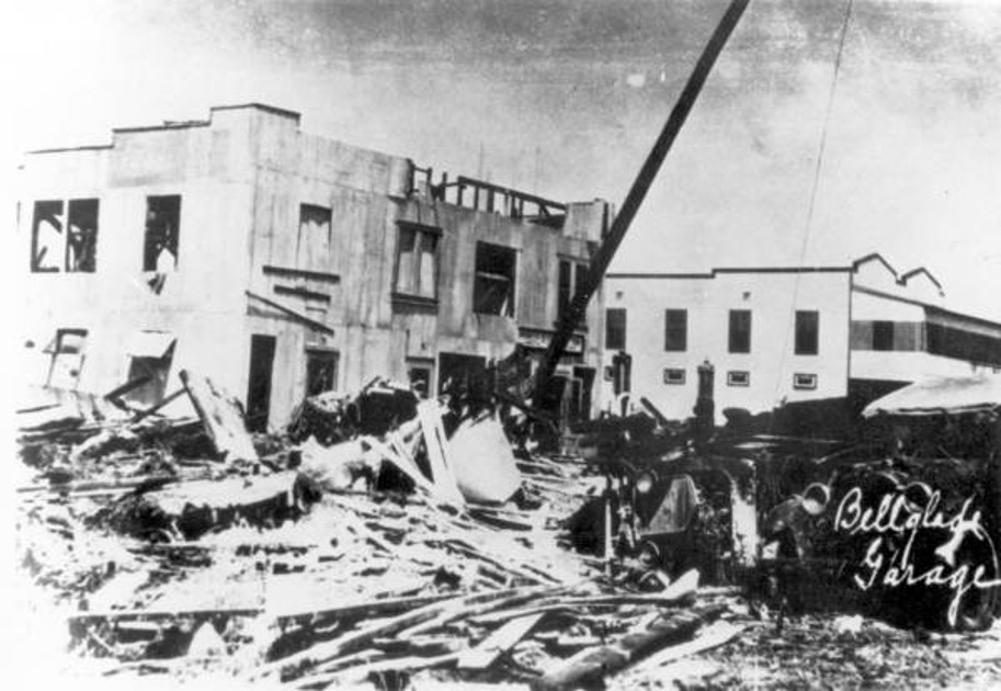
The flood moved rapidly through the developed areas south and southeast of the lake. In Belle Glade, eyewitness accounts compiled by the National Weather Service describe water rising on hotel steps at about an inch per minute. The flood reached approximately seven feet above ground in parts of Belle Glade and more than eleven feet at locations closer to the lake, including Chosen, Torry Island, and South Bay. Buildings were lifted from their foundations, broken apart, or carried into other structures. Roads, canals, utilities, communications, crops, livestock, and farm equipment were damaged over a broad area. The flooded footprint extended for miles across nearly flat terrain (Weather Forecast Office, Miami, n.d.; Florida Memory, 2014).

Community Impacts, Rescue, and Recovery
The human consequences were overwhelming. The National Weather Service now estimates that at least 2,500 deaths from the 1928 hurricane, while the U.S. Army Corps of Engineers summarizes the combined 1926 and 1928 toll as more than 3,000. Historical estimates differ because many victims were migrant laborers, formal records were incomplete, and some bodies were carried far into the Everglades. This case study therefore uses source-specific language rather than presenting a falsely precise total (Weather Forecast Office, Miami, n.d.; USACE, 2025).
The disaster did not affect all residents equally. The communities and agricultural camps south of the lake included a large population of Black and Bahamian migrant farmworkers. The National Weather Service estimates that three-quarters or more of the 1928 victims were non-white field workers. Many lived in light, poorly anchored housing close to the lake, had limited access to reliable warnings and transportation, and were not fully represented in official records. The physical hazard was wind-driven flooding, but the scale and distribution of the loss also reflected where people had been allowed or required to live, the quality of available housing, and unequal access to information and evacuation.
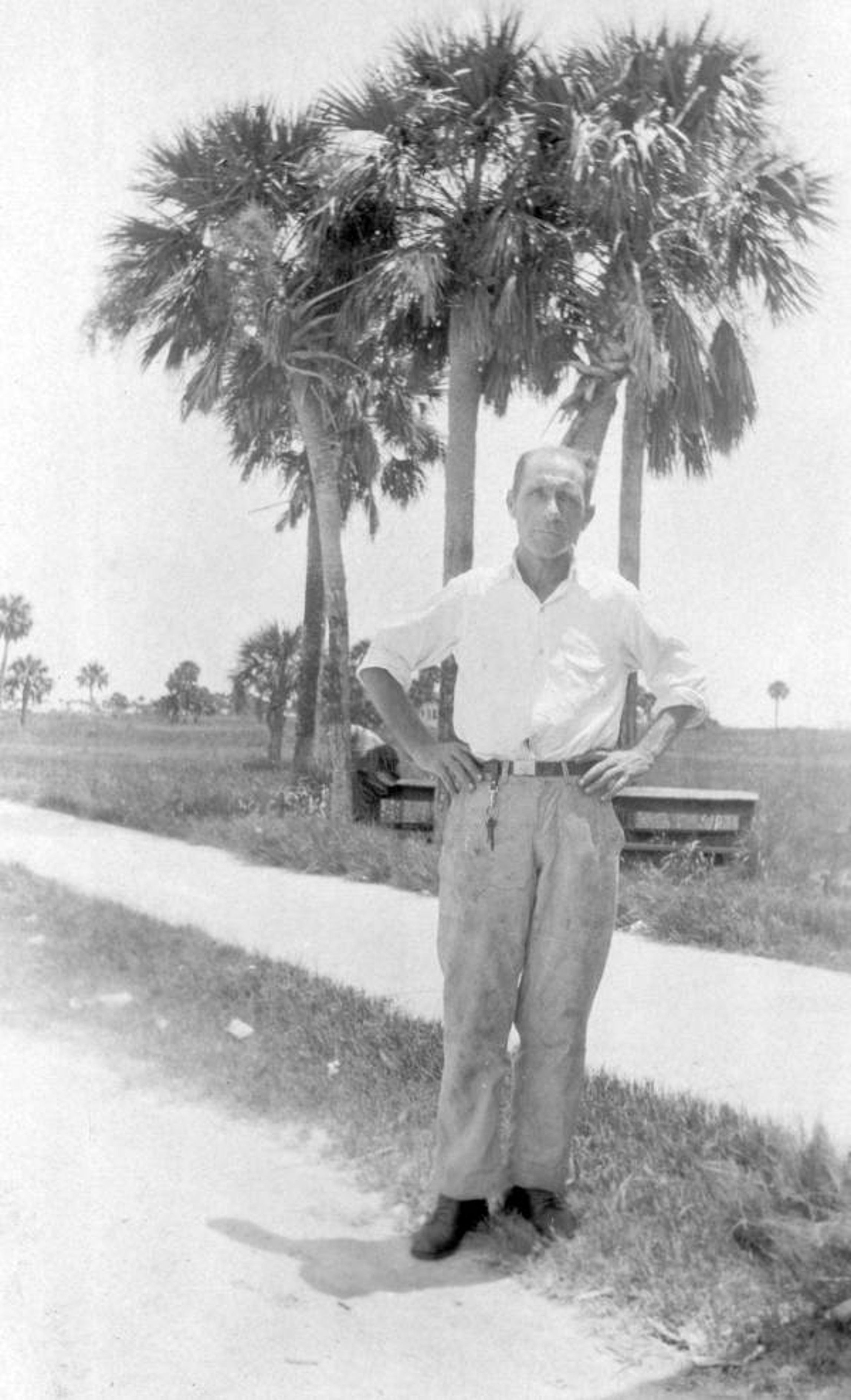
The first response depended heavily on survivors and individual rescuers operating in extreme conditions. One State Board of Health photograph documents an unidentified man who made three trips from Okeechobee City to Upthegrove Beach and was credited with saving 40 people. State and local crews, National Guard personnel, volunteers, and relief organizations then carried out searches, transported survivors, removed debris, recovered victims, and worked to reestablish access and basic services. The operation was slowed by flooded roads, damaged communications, contaminated surroundings, and the size of the inundated area. Floodwater remained for several weeks, and survivors were still being found wandering six days later (Florida Memory, 2014; Weather Forecast Office, Miami, n.d.).
Recovery was inseparable from the handling of the dead. Large numbers of bodies were recovered from fields, canals, ditches, trees, and debris, sometimes days after the storm. Burial practices reflected the segregation of the period. In West Palm Beach, 69 identified white victims were buried at Woodlawn Cemetery, while 674 Black victims or victims whose race was not recorded were placed in a mass grave near Tamarind Avenue. Approximately 1,600 other victims were buried at Port Mayaca. Separate memorial services for white and non-white victims were held at the same time in separate locations. (Weather Forecast Office, Miami, n.d.; Florida Memory, 2001).
Property damage from the 1928 hurricane was estimated at $25 million in 1928 dollars, although that figure includes storm damage beyond the levee-related flood and cannot be cleanly separated into categories. The deeper cost was the destruction of homes, farms, businesses, community institutions, and livelihoods across the lake region. Debris removal and reconstruction continued while the area was still coping with displaced families, damaged agricultural production, and the public-health consequences of prolonged flooding. For the lakeside communities, recovery was not a discrete cleanup project; it was a lengthy process of rebuilding daily life and reconsidering whether the lake could be safely occupied behind the existing levees.
From Local Levees to the Herbert Hoover Dike
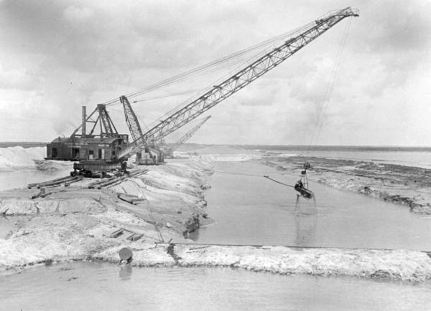
The 1926 and 1928 failures changed flood-control policy around Lake Okeechobee. President-elect Herbert Hoover visited the region after the 1928 hurricane. Florida created the Okeechobee Flood Control District in 1929, and the Rivers and Harbors Act of 1930 authorized federal work that included 67.8 miles of levee along the south shore and 15.7 miles along the north shore. The U.S. Army Corps of Engineers constructed the authorized levees between 1932 and 1938, with crest elevations ranging from +32 to +35 feet NGVD29. Contemporary construction photographs show draglines excavating borrow material, placing embankment, and dressing the slopes. One Florida Memory record describes a $9 million construction phase involving 66 miles of levee and more than 43 million cubic yards of rock and marl (USACE, 2025; Florida Memory, 2014).
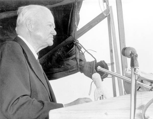
The initial federal project was a major improvement, but it was not the final dike system seen today. Another major hurricane in 1947 exposed the need for broader regional flood protection. Congress authorized the Central and Southern Florida Project in 1948. By the late 1960s, the expanded system formed a 143-mile embankment around Lake Okeechobee, with a maximum crest elevation of about +41 feet NGVD and numerous navigation and water-control structures. Public Law 86-645 designated the Lake Okeechobee levees the Herbert Hoover Dike on July 14, 1960; former President Hoover attended the dedication at Clewiston in 1961 (U.S. Congress, 1960; Florida Memory, 2014; USACE, 2025).
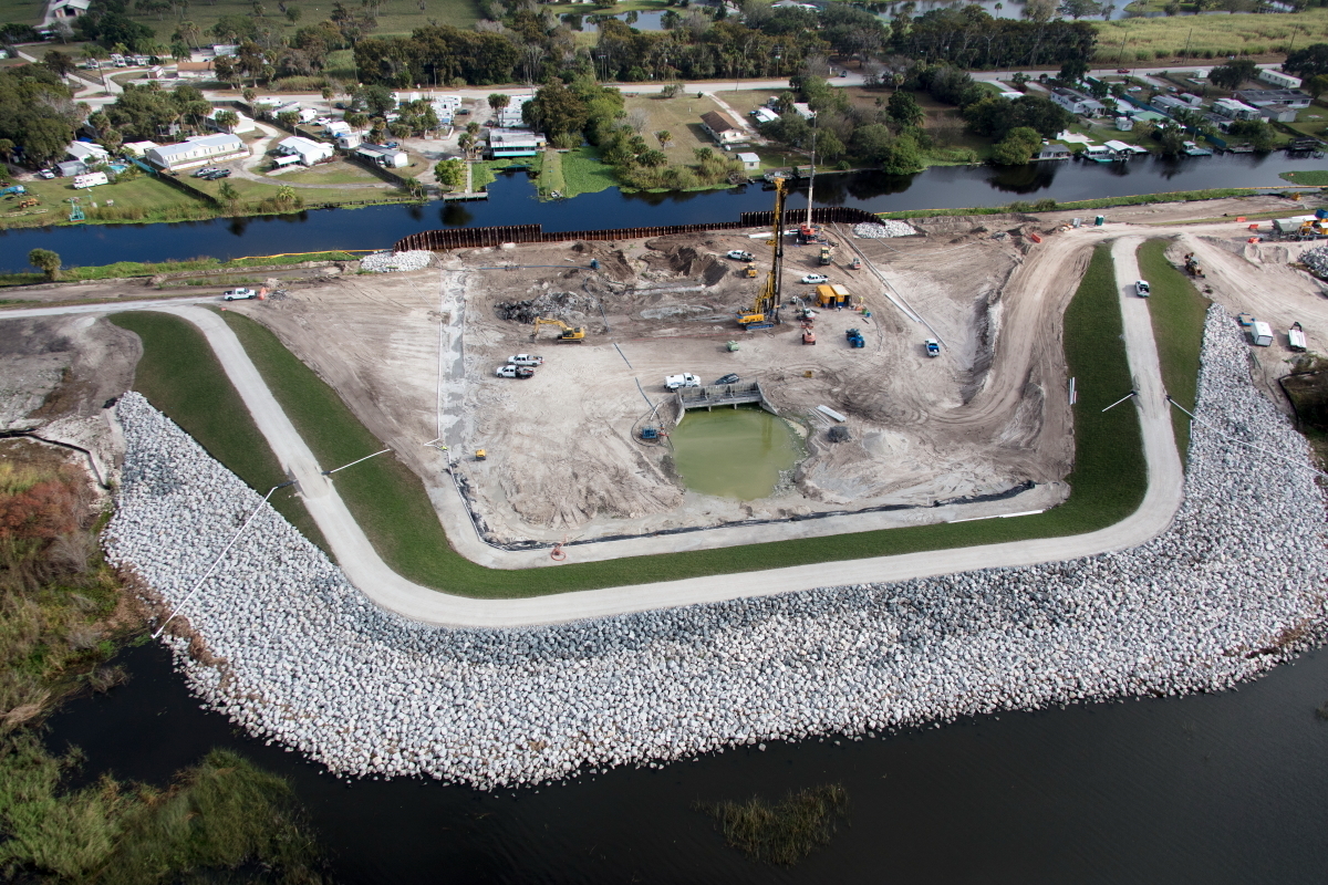
The dike has continued to evolve. Investigations in the 1980s and 1990s identified seepage, foundation, and stability concerns. A major rehabilitation program began in 2005. On January 25, 2023, USACE held a ribbon-cutting to mark completion; its accompanying materials described the work as complete or substantially complete and three years ahead of the 2025 target. The approximately $1.5 billion effort included more than 56 miles of cutoff wall, replacement of 28 water-control structures, and armoring at selected locations. These improvements addressed broader dam-safety concerns than wind-wave overtopping alone, but they reinforce the central lesson from 1926 and 1928: flood protection around a large shallow lake is a life-cycle responsibility, not a one-time construction achievement (USACE, 2023; USACE, 2025).

Dam-Safety Significance
The Lake Okeechobee failures are often remembered as hurricane disasters, but they are also hydraulic structure failures with a clearly identifiable wind-related failure mode. FERC defines wind setup [make “wind setup” italics] as the rise in stillwater level at an embankment caused by wind stress on the water surface and wave runup as the vertical height waves reach above that stillwater level. Required freeboard must account for both. The worst loading combination may not be the highest reservoir level paired with the maximum wind. A maximum or long-duration wind at normal or intermediate pool can be the worst case because those pool levels persist much longer than a brief peak flood stage (FERC, 2015; ASDSO, n.d.).
For an embankment dam or levee, upstream slope and crest protection are structural systems. Depending on the failure mode, protection may include riprap over bedding and filters, soil-cement, articulated concrete blocks, or other engineered armoring. Crest geometry, drainage, transitions, toe details, and maintenance also matter. Each system must be designed for site-specific wind speed, duration, direction, fetch, wave conditions, pool elevation, and the most exposed elevation band. Risk assessments should explicitly screen a “wind-wave erosion of the upstream face and crest leading to overtopping and breach” failure mode. Lake Okeechobee shows how painfully these lessons can be learned: the 1926 failure revealed the hazard, the damaged levee was largely restored to its former condition, and the mechanism produced far greater loss only two years later (ASDSO, n.d.).
Emergency planning must carry the same scenario through response conditions. A regional hurricane can simultaneously damage the embankment, interrupt power and communications, block roads, eliminate safe crest access, and place the population at risk under evacuation orders from multiple hazards. The 1928 recovery also shows that consequence estimates and emergency plans are incomplete if they do not identify transient populations, language and transportation barriers, housing vulnerability, and the practical ability to account for people after an event. Wind loading is therefore not merely a freeboard calculation. It is a system-level dam-safety hazard that links design, maintenance, operations, warning, evacuation, recovery, and long-term public trust.
References:
(1) ASDSO. (N.D.). Lessons Learned. Association of State Dam Safety Officials.
(3) Creech v. United States, 60 F. Supp. 885, 102 Ct. Cl. 301 (1945).
(5) Florida Memory. (2014). When the Dam Breaks... [Slideshow]. State Library and Archives of Florida
(11) South Florida Water Management District. (n.d.). Lake Okeechobee.
This case study summary was peer-reviewed by Mark Baker, P.E. (Dam Crest Consulting) and John W. France, P.E., BC.GE (JWF Consulting).

Lessons Learned

Dam failure sites offer an important opportunity for education and memorialization.
Learn more
Emergency Action Plans can save lives and must be updated, understood, and practiced regularly to be effective.
Learn more
The Study of Past Dam Failures and Incidents is Essential for Keeping Today’s Dams Safe.
Learn more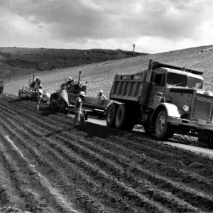
Wind loading can have a significant impact on dam safety.
Learn moreAdditional Lessons Learned (Not Yet Developed)
- Risk reduction is a life-cycle responsibility.

General Design and Construction Considerations for Earth and Rock-Fill Dams, EM 1110-2-2300

Design Standards No. 13: Embankment Dams - Chapters 6
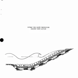
Wind setup, wave runup, freeboard, and site-specific riprap, bedding, and filter design.
Design Standards No. 13: Embankment Dams - Chapter 7
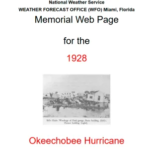
The 1928 Okeechobee Hurricane
Primary public-source synthesis for community impacts and response.
Herbert Hoover Dike, FL
Current official history, dimensions, construction chronology, and rehabilitation status.
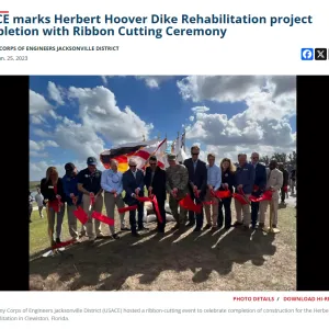
USACE Marks Herbert Hoover Dike Rehabilitation Project Completion
Caloosahatchee River and Lake Okeechobee Drainage Areas, Florida
Contemporaneous federal engineering assessment of 1926 and 1928 levee performance and post-1928 design recommendations.

Hurricane Gate Structure 4, Herbert Hoover Dike on Lake Okeechobee
Historic engineering documentation and federal construction history.
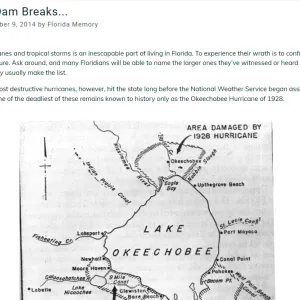
When the Dam Breaks...