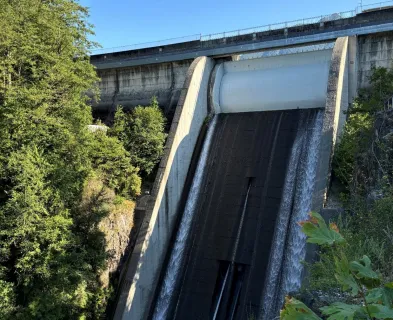
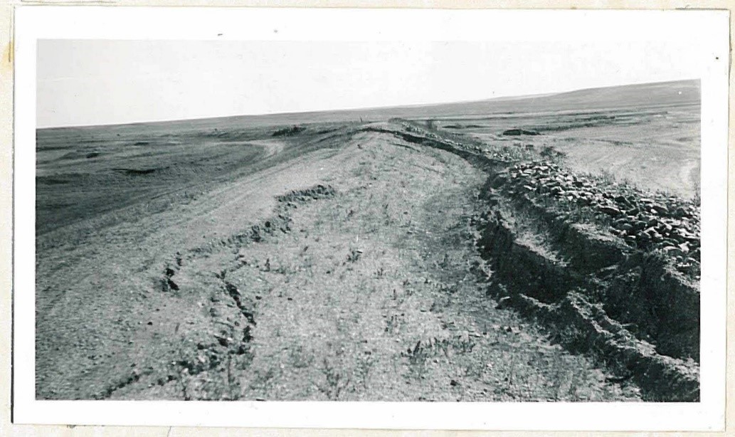
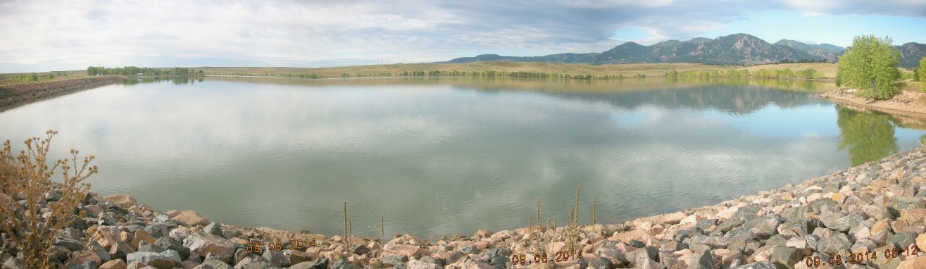
Routine inspections of Marshall Lake Dam in the early 21st century were relatively uneventful. The 75-foot-tall, 2,400-foot-long high hazard earth embankment dam had relatively flat slopes (3H:1V upstream and downstream), a 200-foot-wide downstream stability berm, very little discharge from the internal seepage collection drains, a reasonably large outlet works pipe with multiple control points, and a recently constructed concrete-lined spillway designed to accommodate flood inflows approaching the PMF. The caretaker lived on-site and provided daily visual observations of the dam and collected weekly readings of the dam safety instrumentation, which fluctuated predictably with the reservoir fluctuations. The only noteworthy comment in the inspection reports highlighted a persistent depression occurring near station 4+00 that the caretaker had consistently attributed to vehicle rutting damage.
During the routine 2017 dam inspection, however, a review of movement monument survey data collected between 1980 and 2016 revealed minor but progressive settlement and downstream movement of the dam crest coupled with equivalent uplift and downstream movement along the interface of the upper downstream slope and stability berm. The movement resembled that of a rotational slope failure and, perhaps not coincidentally, was most significant near station 4+00 where the persistent dam crest depression had been observed. This observation prompted a comprehensive review of the dam’s history, which revealed the following unsettling events.

Marshall Lake Dam was originally built around 1885 to provide water supply for some of the original coal miners on the Marshall Mesa just south of Boulder, Colorado. The original 24-foot-tall dam was raised by roughly 25-feet from the downstream side in 1907. The construction was initially completed using the hydraulic fill method, however the construction method was modified to replace the sluice delivery system with side dumping from tracked rail cars into the semi-liquid embankment material. According to Jansen (1983), this alternative delivery system “was adopted at some sites where there was not enough water to transport materials over longer distances,” which is a plausible explanation for the semi-arid Marshall Mesa region. A second raise from the downstream side was completed shortly thereafter in 1909 following the same construction method to bring the dam to its current 75-foot height. The finished dam had a 3H:1V upstream slope and 2H:1V downstream slope.
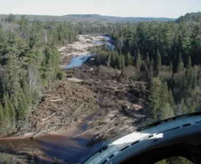
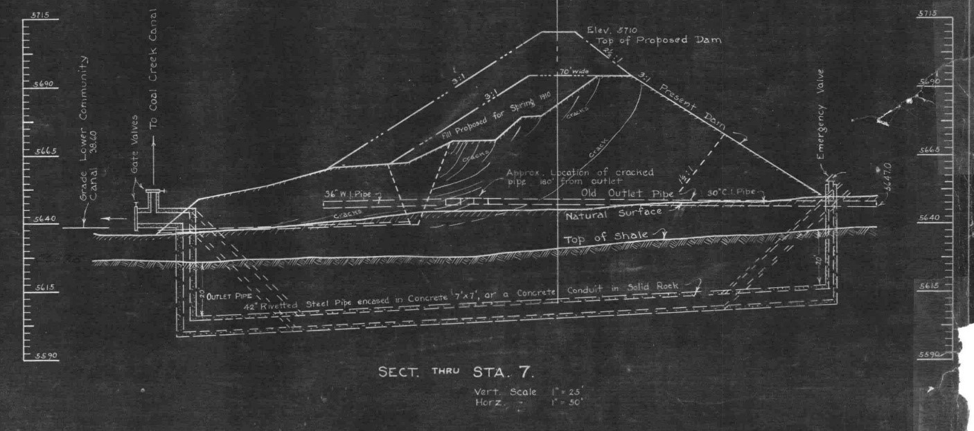
Shortly following the first reservoir fill in 1910, a rotational failure of the downstream slope developed, extending through the dam crest to the upstream slope. The reservoir level at the time of the failure was not documented; however, the slope failure did not lead to an uncontrolled loss of the reservoir contents. The caretaker was able to drain the reservoir despite severe damage to the 30-inch diameter CMP outlet pipe. The dam was rebuilt in 1910 with a slightly flatter (3H:1V) downstream slope and a new 48-inch-diameter inverted siphon outlet works that tunneled through the Laramie Formation claystone foundation approximately 20 feet below the presumed bedrock surface. The upstream two-thirds of the original 30-inch outlet pipe was abandoned in-place with only a minor cap on the upstream end.
The Colorado State Engineer’s Biennial Report from 1921-22 states, “The reservoir was used for several years [following the 1910 repairs] without any serious mishaps although there was some settlement” until another downstream slope failure developed in 1921 in approximately the same location as the 1910 event. The 1921 failure, however, was initiated by an intense, widespread rain event that was reported to have filled the top 6 feet of the reservoir over a span of 3 days. The long-duration rain event may also have saturated the downstream slope and created high excess pore pressures in the fat clay embankment, which would have weakened the downstream slope. One account reported by the Boulder Daily Camera newspaper in June 1921 states that the Marshall Lake Dam superintendent “…did not think there was danger of the Marshall Dam breaking [though] it has settled two or three feet.” Despite the superintendent’s comments, the danger was apparent enough that the local passenger train was re-routed to a neighboring town in recognition of the potential dam breach. The embankment “settlement” ultimately dropped the dam crest by roughly 17 feet along a 200-foot-long dam length over about 12 days. The displaced material was deposited along the downstream toe. Though the peak reservoir level reached within 3 feet of the dam crest during the rain event, the 1921 slope failure didn’t lead to an uncontrolled loss of the reservoir because the 48-inch-diameter outlet works flow capacity was sufficient to lower the reservoir at about the same rate as the embankment settlement was developing.
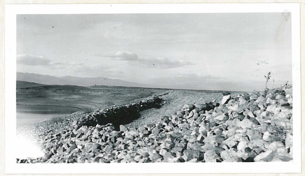
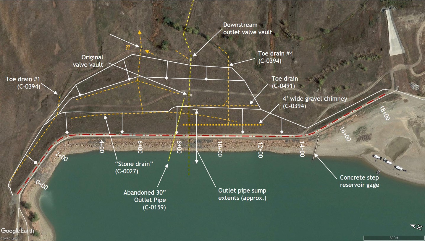
The dam was reconstructed in 1922 to include a 200-foot-wide stability berm with a top elevation about 30 feet below the dam crest and a series of “loose rock” internal drains. The stability berm was constructed only in the embankment reach to the north of the outlet works (stations 2+50 to 8+00). Similar to the embankment enlargements, the construction is suspected to have followed the hydraulic fill method since that was the state of the practice at that time, though this has not been confirmed. The 1922 construction also included an attempt to improve the abandonment of the original outlet works pipe, as the design engineer identified the original abandonment as inadequate; however, the 1922 pipe abandonment efforts remain woefully inadequate by modern standards.
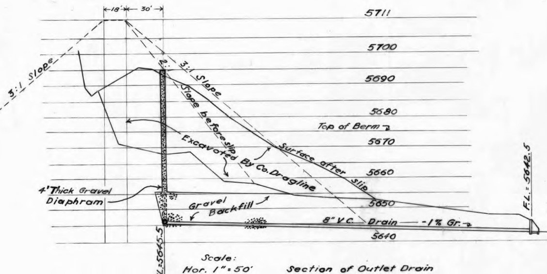
The dam operated successfully for another 20 years until a third downstream slope failure occurred in 1942. This failure occurred along the previously unimproved dam reach south of the outlet works alignment between stations 9+00 and 12+50. Record drawings for the repair project indicate that the dam crest dropped approximately 16 feet and the failed section resembled a typical rotational downstream slope failure with mobilized material deposited at the downstream toe. The reservoir level at the time of failure is unknown; however, this failure again did not result in an uncontrolled release of the reservoir. The exact cause of this slope failure is unclear. Similar to the 1921 failure, the 1942 failure occurred following a moderately heavy rain event; however, no association between the rain and the failure is made in the historical records. The design engineer for the 1942 repair attributed the failure to “a seam of coal dust about 5-feet-thick” discovered within the embankment during excavation of the failed slope material. The downstream slope was reconstructed to 3H:1V following roller-compacted earth fill techniques, and included a 4-foot-thick “gravel” chimney filter rising to within 20 feet of the dam crest with an 8-inch tile seepage collection drain pipe.
A fourth downstream slope failure developed in 1946 in the same location as the 1942 slope failure. This slope failure was notably less significant than the previous failure in this location, dropping the dam crest by 2 feet in a 200-foot-wide reach, but was sufficient to prompt extension of the 1922 stability berm to the south of the outlet works alignment. This slope failure was initially attributed to “the solutioning of soluble salts in the embankment,” and later to a leaky outlet pipe.
In the late 1970s, a Boulder County geologist informed the Colorado State Engineer’s office that coal mine activity in the second half of the 19th century on the Marshall Mesa may have created tunnels extending fully through the foundation of the dam, and that these open tunnel could be the cause of past and future subsidence problems in and around the dam. Further research into this concern was conducted over the following few years until a Phase 1 Inspection by the U.S. Army Corps of Engineers in 1980 essentially discredited these concerns, concluding that the mine tunnels, if they exist at all, would be too deep and not likely to have contributed to past slope failures. No further mention of the historical coal mines occurs in the Colorado State Engineer’s records.

The dam performed satisfactorily thereafter until a fifth slope failure developed in 2010, this time on the upstream slope at the far north end of the dam. This event was isolated to the upstream slope (no impact to the dam crest) and was attributed to a rapid drawdown condition despite the reservoir having been drawn down at this same rate (about 0.25 feet per day) for many years prior. A subsequent limited geotechnical investigation in this area (also the first documented geotechnical investigation performed at this dam) revealed poorly consolidated clayey soils with very low soil strength parameters and suggested that the soils were behaving in a fully-softened condition. Localized repairs to the damaged section of the upstream slope included reconstruction to a slightly flatter inclination and replacement of the fat clay soils with more permeable sandy material.
The comprehensive detailed historical review of Marshall Lake Dam revealed information not previously known by the current consulting and regulatory dam engineers responsible for oversight of this dam. The most significant revelations included the four downstream slope failures, the hydraulic fill construction method used to construct the dam, the suspicion that open remnant coal mine tunnels may extend through the foundation, the poorly abandoned outlet works pipe extending through a portion of the dam, and identification of the foundation bedrock as the Laramie Formation. The Laramie Formation foundation is significant because three other similar dams in the Denver Front Range share this same foundation, and each have experienced slope failures that required substantial slope stabilization repair projects. The underlying problem is, “The Laramie claystone has poor foundation strength characteristics because it is highly plastic and slickensided, with relatively high in-situ stresses. Its strength degrades over time due to stress relief when disturbed by excavation and wetting and drying. Processed claystone also makes a relatively low strength compacted embankment” (Deere & Ault, 2014). For this reason, we suspect that the embankment and foundation materials may have inherently poor qualities for dam building, which may be a contributing factor in the historical slope failures and recently recorded movement at Marshall Lake Dam.
The information revealed during the comprehensive review provided a better understanding of the embankment construction methods, highlighted the long history of embankment instability, and revealed outstanding and unresolved dam safety concerns. This knowledge, coupled with the recently observed and documented embankment movement near station 4+00, generated sufficient concern about the stability of the dam to warrant immediate action by the dam owner and implementation of a focused long-term monitoring program. Without the comprehensive review, the minor dam crest depression and embankment movement might have continued to be brushed aside as a “normal nuisance condition,” which might have paved the way for another, and potentially more devastating, slope failure at Marshall Lake Dam.
References:
(2) Baker, G.R. (1906). Specifications for the Enlargement of the Dam of Marshall Reservoir.
(3) The Arnold Company Engineers. (1910). Marshall Lake Dam Construction Record Drawings. Chicago.
(4) (1922). Plans and Cross Section of Marshall Lake Dam.
(5) Colorado State Engineer’s Office. (1923). Twenty First Biennial Report.
(6) Downing, R.L. (1942). Revised Plan for Reconstruction of Marshall Lake Dam.
(7) Mitton, C.L. (1943). Marshall Lake Dam Construction Report.
(8) Caley, J.H. (1948). Plans for the Construction of an Earth Embankment Along the Downstream Face of Marshall Lake Dam.
(9) Ecological Resource Consultants, Inc. (2010). Marshall Reservoir Left Abutment Embankment Repairs.
(10) Ecological Resource Consultants, Inc. (2010). Technical Memorandum – Marshall Dam Repairs.
(11) Jansen, R.B. (1983). Dams and Public Safety. U.S. Bureau of Reclamation.
(12) Deere & Ault Consultants, Inc. (2014). Woman Creek Dam and Reservoir Rehabilitation Design Report.
This case study summary was peer-reviewed by Alon Dominitz, P.E., NY Department of Environmental Conservation.


Lessons Learned

A complete and thorough dam record is essential.
Learn more
All dams need an operable means of drawing down the reservoir.
Learn more
Dam incidents and failures can fundamentally be attributed to human factors.
Learn more
Dams should be thoroughly assessed for risk using a periodic risk review process including a site inspection, review of original design/construction/performance, and analysis of potential failure modes and consequences of failure.
Learn more
Earth and rockfill embankment dams must be stable under the full range of anticipated loading conditions.
Learn more
Intervention can stop or minimize consequences of a dam failure. Warning signs should not be ignored.
Learn more
Regular operation, maintenance, and inspection of dams is important to the early detection and prevention of dam failure.
Learn more
Stability of the dam foundation and other geologic features must be considered during dam design.
Learn more
The first filling of a reservoir should be planned, controlled, and monitored.
Learn moreAdditional Lessons Learned (Not Yet Developed)
- Comprehensive reviews are necessary.
- Poor compaction, steep abutments, and foundation discontinuities can lead to differential settlement, cracking, and failure by internal erosion.
- Many years of successful dam performance does not guarantee future successful performance.
")
")

Design Standards No. 13: Embankment Dams - Chapter 13
")

Slope Stability, EM 1110-2-1902