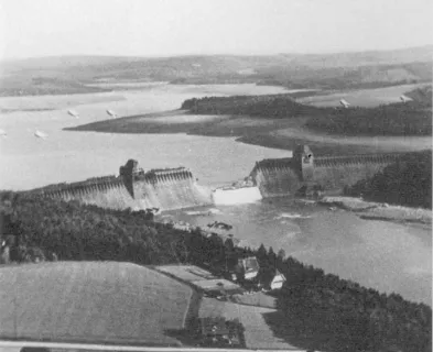
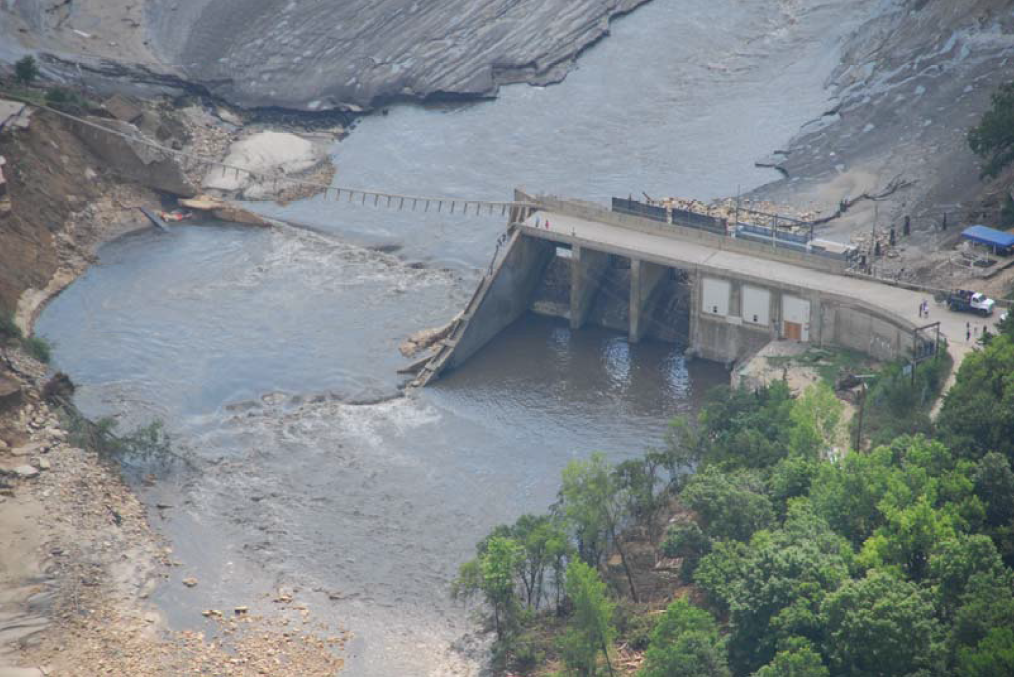
A design flood is the flood hydrograph that is used to design and/or modify a specific dam and its appurtenant works; particularly for sizing the spillway and outlet works, and for evaluating maximum storage, height of dam, and freeboard requirements. One of the most common causes of dam failures is the inability to safely pass flood flows. Failures caused by hydrologic conditions that exceed the design flood of the dam can range from sudden failure, with complete breaching or collapse of the dam, to gradual failure, with progressive erosion and partial breaching. The most common potential failure modes associated with hydrologic conditions that exceed the design flood of the dam include overtopping erosion, erosion of spillways, internal erosion (seepage and piping) at high reservoir levels, and overstressing the structural components of the dam.

Over time, the methods used to identify an appropriate design flood for a dam have evolved. In the early period of dam building in the United States, design flood selection began primarily as a practical concern for protection of a dam and the benefits it provides. Prior to 1950, regulatory guidelines and design standards for the hydrologic safety of dams were still based mainly on engineering judgment and experience. Through the years, elegant theoretical and mathematical approaches were developed to allow the evaluation of a watershed’s response to extreme precipitation. A common design flood for dams is the flood resulting from the Probable Maximum Precipitation (PMP). The PMP represents the theoretically greatest depth of precipitation for a given duration that is physically possible over a given storm area at a particular geographic location at a certain time of the year. PMP estimates in conjunction with watershed models to compute flood runoff have been widely accepted over the past few decades as the basis for the evaluation and design of dams where failure of the structure cannot be tolerated.
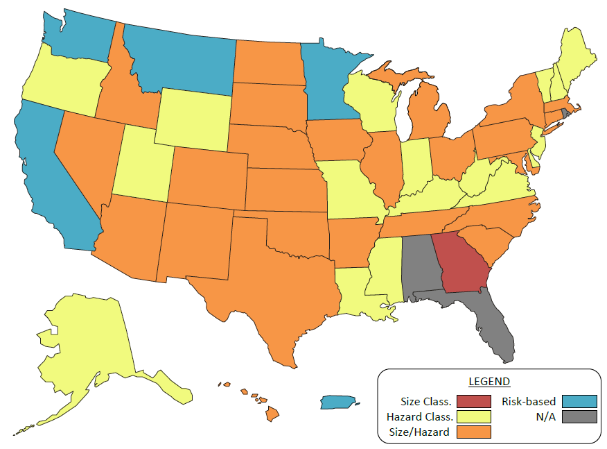
Today, most regulatory agencies assign a design flood based on an assessment of potential hazard or risk of a particular dam. No single approach to the selection of a design flood is adequate for the unique situations of thousands of existing or planned dams. Many alternative approaches including risk-informed decision making, incremental consequence analysis, and the application of prescriptive criteria have been successfully applied in assigning an appropriate design flood. These approaches are described in greater detail in the federal guidance document entitled, FEMA 94 – Selecting and Accommodating Inflow Design Floods for Dams. Many dams that are currently classified as having a high or significant hazard potential were designed and constructed prior to the availability of extreme rainfall data and do not comply with the current regulations or standard of practice. These dams should be assessed using current data and methodologies and, if necessary, be rehabilitated to increase spillway capacity. Additionally, new development downstream of existing dams, a phenomenon referred to as risk creep (also commonly called hazard creep), is resulting in increased potential consequences that would occur if a dam were to fail. This evolution can result in the reclassification of many dams to a higher hazard category which requires greater spillway capacity and/or reservoir storage volume.
"Recent and ongoing technical advances are improving the assessment of the likelihood of extreme hydrologic events as well as the prediction of the characteristics of hydrologic events and potential dam failure consequences. These include improved computer models to simulate watershed runoff and dam failure flood waves; increased availability of high resolution terrain, census, and land use data; improved understanding of rare hydrologic events; consideration of geologic evidence of ancient flood events; and site-specific PMP studies. These advances provide engineers with the ability to perform sophisticated evaluations of dam designs to more precisely evaluate risks associated with hydrologic events through better understanding of hydrologic events, potential hydrologic failure modes, and the consequences of a dam failure. When warranted, engineers can perform additional investigations using advanced analytical tools and methods to more precisely evaluate incremental consequences and dam failure probabilities. This information can be used to select a design flood that reduces risk to the public without spending limited resources on conservative designs that result in marginal reduction of flood risk.
“Due to the importance of safely accommodating the design flood and floods of lesser magnitude, all spillway designs and analyses should be performed, or directed and reviewed by a registered professional engineer experienced in hydrology and hydraulics.” ¹
References:


Banqiao Dam (China, 1975)

Buffalo Creek Dam (West Virginia, 1972)

Canyon Lake Dam (South Dakota, 1972)

Castlewood Canyon Dam (Colorado, 1933)

El Guapo Dam (Venezuela, 1999)

Equalizer Dam (Colorado)

Front Range Flood (Colorado, 2013)

Ka Loko Dam (Hawaii, 2006)
Kelly Barnes Dam (Georgia, 1977)

Lake Delhi Dam (Iowa, 2010)

Laurel Run Dam (Pennsylvania, 1977)

Machhu Dam II (Gujarat, India, 1979)

Palagnedra Dam (Switzerland, 1978)

Schaeffer Dam (Colorado, 1921)

South Fork Dam (Pennsylvania, 1889)

Swift and Two Medicine Dams (Montana, 1964)

Testalinden Dam (British Columbia, 2010)

Tous Dam (Spain, 1982)

Walnut Grove Dam (Arizona, 1890)
Additional Case Studies (Not Yet Developed)
- Timberlake Dam (Virginia, 1995)
- Callaway Dam (Texas, 2004)


Selecting and Accommodating Inflow Design Floods for Dams

Summary of Existing Guidelines for Hydrologic Safety of Dams

Technical Manual: Overtopping Protection for Dams


Design Hydrology (Dams) - Module 209

Hydraulic Design of Spillways, EM 1110-2-1603

Hydrologic Engineering Requirements for Reservoirs, EM-1110-2-1420