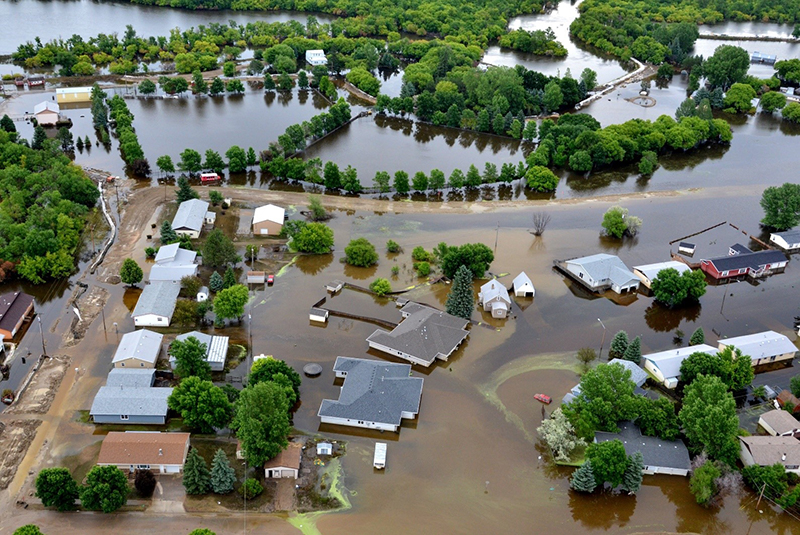
A dam incident can be described as an impending or actual sudden uncontrolled release or excessive controlled release of water from an impounding structure. This may be caused by damage to or failure of the structure, flood conditions unrelated to failure, or any condition that may affect the safe operation of the dam. Dam owners, operators, and community emergency management authorities must work together to protect residents, workers and visitors in areas threatened by damaging floodwaters to avoid loss of life and injuries [1].
Lessons Learned from Historic Events
The historic record of dam failures clearly shows that no warning, limited warning times, or no prior evacuation before failure can have a fundamental influence on loss and survival outcomes for people located in inundation zones. Specific examples of cases with limited, ineffective or no warning include:
| Dam Facility | Location | Year | Fatalities |
| Austin Dam | Pennsylvania | 1911 | 78 |
| Canyon Lake | South Dakota | 1972 | 238 |
| Malpasset Dam | France | 1959 | 421 |
| South Fork Dam | Pennsylvania | 1889 | 2,209 |
| Vajont Dam | Italy | 1953 | 2,056 |
Eyewitness accounts from the Canyon Lake Dam / Rapid City flood provide insights into the importance of warning effectiveness and rapid response [2]:
“When we heard the warning, we thought he (the Mayor) was kidding. We just sat there, and pretty soon this big bunch of water came down the creek. We ran next door and suddenly the water was up to my neck. The top of a house came floating by and we grabbed on to that. A little way downstream we got off and climbed on the roof of a neighbor's house. We stayed there until the flood began to fall on Saturday.”
“The people were crying and screaming for help. And you could just see the people floating around, just before your eyes. Some going under ... some floating in a car or in a house ... it's just terrible. A car floated down the main street where we live, so we tried to make it on foot toward a hill and couldn't make it. My husband almost floated away, but the children grabbed him. We went back to the house and the water came up to our necks. We just stood there until the water came down to our waists and we were rescued.”
The Reclamation Consequence Estimation Methodology (RCEM) [3] provides a useful compilation of dam failure and flood event case histories that include assessments of whether or not community warnings had been issued, and whether warning times were adequate [4]. A precursor to RCEM is Graham [5] , who found that life loss from dam failures were influenced by three factors: the population at risk, amount of warning, and severity of flooding.
The historic record also provides examples that clearly demonstrate the value and importance of warning time and the rapid responses by the community and population at risk during dam failures:
Dam Facility: Baldwin Hills
Location: California
Year: 1963
Fatalities: 5
Value of Warning / Evacuation: Baldwin Hills Dam was an embankment structure situated on a hilltop and consisted of the main dam and three interconnected dikes which together formed a “ring” to enclose the reservoir. The dam failed at 3:38 pm on Saturday, December 14, 1963. Early detection of unusual behavior of the dam, early warning and evacuation of the community before dam breach and flood arrival, and rescue during the flooding are all credited with saving lives:
-
- Seepage from the dam was detected at 11:15 am on December 14, 1963, and an attempt was made to draw down the reservoir[4].
- The decision to issue evacuation orders was made at 1:45 pm, 1 hour and 53 minutes before failure. “Neighborhoods were cordoned off and warnings were strongly issued via emergency alert broadcasts, helicopters with bullhorns, and by policeman going door-to-door.” The pre-evacuated population was estimated at 16,500 people, and at least 1,000 are thought to have remained in the flood zone. [4]
- Numerous houses were damaged or destroyed immediately downstream of the dam, but no fatalities occurred due to a successful evacuation. All five fatalities occurred 0.4 miles downstream at Village Green, including three people travelling in the same vehicle. [4]
- Eyewitness accounts recorded at a 50th anniversary event provide some insights into efforts by the police to warn the community as the floodwaters approached: [6]
- - “A hundred motorcycle cops came in to evacuate people. About half of them lost their motorcycles in the flood. If this had happened at 2 in the morning, maybe a thousand people could have been killed."
- "Police black-and-whites were floating down La Brea like Dixie cups."
- Helicopter-based rescues of 18 people caught by the flooding were also credited with saving lives. [4]
Dam Facility: St. Francis Dam
Location: California
Year: 1928
Fatalities: 432+
Value of Warning / Evacuation: St. Francis Dam was an arched concrete gravity dam. It failed near midnight on March 12-13, 1928. For those living within the first 18 miles of the dam, warning and evacuation was not possible; however, community warning and evacuation saved many lives further downstream [7]:
-
- The power and telephone utilities had night operators on station. Communities distant from the dam had time for their police and fire personnel to be notified.
- The police moved rapidly up and down the valley through the communities to warn people, and neighbors helped to spread the word. There were numerous examples of individual initiatives taken to save lives.
- In one town, news of the oncoming flood drew more than one hundred people to a local bridge to see the flood pass by. They were moved off the bridge by the police before the wave arrived to destroy the structure.
- The courage, creativity and rapid response of the telephone operators and first responders was remarkable. There was no response plan in place, the community was not aware of the potential extent of the flood hazard impacts, the population had to evacuate immediately in the middle of the night, people did not know where to go, and parts of the valley experienced a power outage.
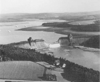
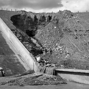
Dam Facility: Teton Dam
Location: Idaho
Year: 1976
Fatalities: 11
Value of Warning / Evacuation: Teton Dam was a central-core, zoned embankment dam. It failed during first filling on Saturday, June 6, 1976. Graham [8] and USBR [4] summarize the warnings, evacuations and flood impacts during the Teton Dam failure:
-
- The floodwaters were very dangerous: Fremont County had 134 homes destroyed / 14 homes damaged, and Madison County had 493 homes destroyed / 2,211 homes damaged.
- Flooding reached the town of Wilford, located 8.4 miles downstream of the dam, within 30 minutes. Five fatalities occurred and 120 of 154 homes were swept away.
- Early detection of the dam failure, recognition of the need to alert and warn the public by Reclamation staff at the dam, excellent on-site reporting by radio broadcaster Don Ellis of Rexburg’s KRXK, warnings and evacuation orders issued by local and state law enforcement officials, and word-of-mouth warning between neighbors, relatives and friends, provided the opportunity for people to move from harm’s way before the flood arrived. Of the 11 people who died, only one was not warned” [8, 9].
- More than 30,000 people were evacuated. The consequences would have been more extreme if the dam had failed at night with no warning. * Although evacuations during these events saved many lives, it is important to note that loss of life still occurred.
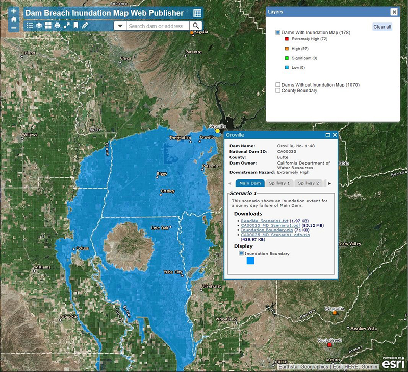
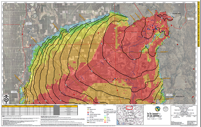
A modern-day example of a dam safety incident that required extensive warning and evacuation of communities is the Oroville Dam Spillway incident of February 2017 [10]. Although there was no loss of life during the event, the Oroville event has provided useful objective data about how communities can respond to dam safety incidents, how long it can take to warn and mobilize the population, and how long it can take to evacuate a community [11, 12]. Additional insights and lessons learned will be gained as dam safety and disaster researchers continue their studies of these types of events.
A Framework for Timely Notification, Public Warning and Protective Action
The Risk Management Center of the US Army Corps of Engineers has worked with disaster researchers to develop an important guide to “assist the emergency manager in issuing more timely and effective public alert and warning messages for floods caused by dam breaches, controlled dam releases, and levee breaches or overtopping” [13]. Figure 1 presents a structured approach that shows key decision points and actions that need to occur along an emergency response timeline:

- Threat Detection to First Alert: “Warning Delay Time”: The timeline can begin with the observation of seismic, meteorological, structural, or other symptoms that a possible incident is in progress, that the structure is already progressing to failure, or the structure has failed. After initial identification of the threat, there may be warning delay time required to evaluate and confirm that the hazard is serious enough to warrant notifying community emergency managers and for the managers to issue a first alert/warning to the community (“warning issued”).
- First Alert to Warning Received: “Warning Diffusion Time”: This is followed by a warning diffusion time from when the first alert is issued by the community emergency managers to when the population has received the alert/warning (“warning received”).
- Warning Received to Protective Action: “Protective Action Initiation Time”: A protective action initiation time covers the period when the population located in the flood inundation zone will take a range of actions to prepare for implementing their own protective actions.
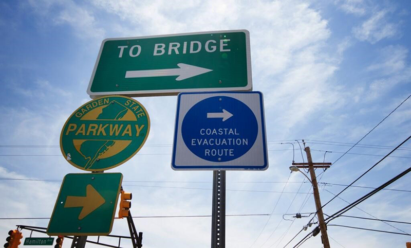
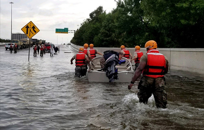
- “Protective Action Completion Time”: The population at risk can take one of two primary protective actions during a dam safety incident: shelter-in-place (sometimes called vertical evacuation for flooding events) or evacuate from the flood impact zone [14]. Examples are provided in the “Photos” and “Videos” resources.
Together, the time spans in Figure 1 form a chain that must work in a timely manner so that the people at risk have sufficient time to receive and understand the warning, and to prepare for and complete their protective actions.
Additional Guidance
Additional guidance and examples of best practices to address warning time and community response can also be considered:
- EAP Guidelines: Guidelines for the development of Emergency Action Plans for dam incidents have been developed and are generally available. It is important to note that warning and evacuation planning are the responsibility of local emergency management authorities: “Evacuation planning and implementation is typically the responsibility of State or local emergency management authorities. Although an EAP does not need to include an evacuation plan, it should indicate who is responsible for evacuation and whose plan will be followed [1].” However, there may be situations in which routine notification will not be sufficient, and the dam owner may need to arrange for direct notification.
- Guidelines for Public Alerting and Warning: USACE [13] provides additional detailed guidelines for public alerting and warning. This includes: matching public protective actions to the threat level, minimizing first alert / warning issuance delay, developing effective emergency messages, selecting dissemination channels, accelerating alerts and warning diffusion, and reducing public action delay.
- Drills and Exercises: Dam owners and community emergency response organizations can organize drills, table-top exercises, functional exercises, and full-scale exercises in order to develop local awareness and skills, to practice and learn how to improve responses, to build and sustain relationships between the dam owner and community first responders and emergency managers [14]. Examples are provided in the “Videos” resources.
- Estimating Protective Action Timelines Using Simulators: For larger-scale emergency events that could affect very large populations, and which cannot be feasibly be practiced using drills or evacuation exercises, it is possible to use simulation-based methods to assess the effectiveness of EAPs and evacuation plans by modeling warning delays, warning diffusion throughout the community, mobilization, and protective actions (shelter, evacuation, or combinations). Examples include the USACE’s LifeSim simulator [15] and the Life Safety Model [7].
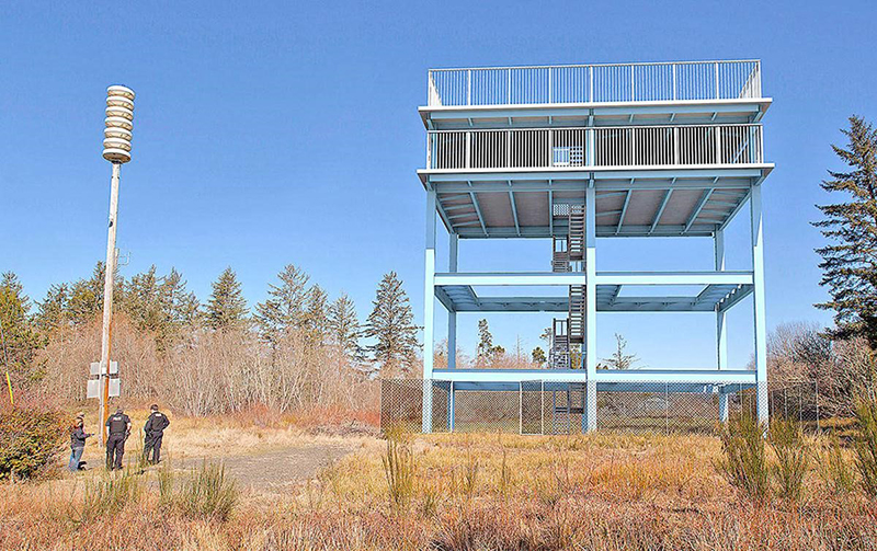
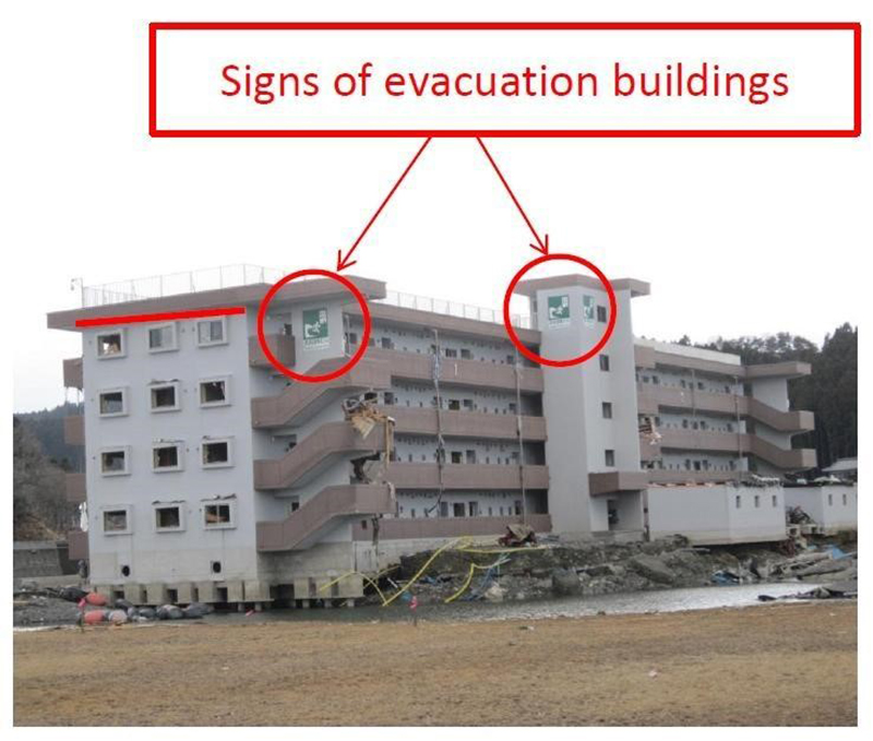
- Lessons and Best Practices from Other Hazard Domains: Dam failures share many properties with other hazards that have the potential for rapid arrival times and extensive damage such as flash floods, tsunami, volcanic lahar and wildland-urban interface fire [16]. Selected best practices from those domains that might apply to dam safety incident response include tsunami and lahar evacuation exercises (See "Videos" resources) and guidelines for vertical evacuation structures [17].
References:
(2) Schwarz, et al. (1975). The Black Hills - Rapid City Flood of June 9-10, 1972: A Description of Storm and Flood. Geological Survey Professional Paper 877. National Weather Service, US Geological Survey.
(6) Pool, B. (2013, Dec 14). On 50th Anniversary, Survivors Recall Baldwin Hills Dam Collapse. Los Angeles Times.
(9) BYU-Idaho. (2016). "Edge of Desolation": 40th Anniversary of the Teton Dam Disaster: Don Ellis, KRXK. Special Collections, Brigham Young University - Idaho.
(11) Sager, W. & Wilson, W. (2018). Spillway Emergency: The Story of the Failure of the Oroville Dam Spillway and the Evacuation of Oroville.
(12) Needham, J., Sorensen, J.H. and Mileti, D.S. (2018). Warnings and the Human Response During the Crisis at Oroville Dam. Hydropower & Dams.
(13) Mileti, D.S. & Sorensen, J.H. (2015). A Guide to Public Alerts and Warnings for Dam and Levee Emergencies. US Army Corps of Engineers Risk Management Center.
(14) Lindell, M.K., Prater, C.S. & Perry, R.W. (2007). Introduction to Emergency Management. John Wiley & Sons, Inc.
(15) HEC-USACE. (2018). HEC-LifeSim: Life Loss Estimation User's Manual, Version 1.01 (CPD-97). Hydraulic Engineering Center, US Army Corps of Engineers.
(16) Stein, et al. (2013). Wildfire, Wildlands and People: Understanding and Preparing for Wildfire in the Wildland-Urban Interface - a Forests on the Edge Report. General Technical Report RMRS-GTR-299. US Department of Agriculture, Forest Service, Rocky Mountain Research Station.
This lesson learned was peer-reviewed by Lee Mauney, P.E., CFM (HDR, Inc.) and Wayne Graham, P.E. (Bureau of Reclamation, Retired).


Austin (Bayless) Dam (Pennsylvania, 1911)

Baldwin Hills Dam (California, 1963)

Barahona No. 1 Dam (Chile, 1928)

Canyon Lake Dam (South Dakota, 1972)

Castlewood Canyon Dam (Colorado, 1933)

Cleveland Dam (British Columbia, 2020)

Columbia River Levees at Vanport (Oregon, 1948)

Edenville Dam (Michigan, 2020)

El Guapo Dam (Venezuela, 1999)

Folsom Dam (California, 1995)
Fontenelle Dam (Wyoming, 1965)

Glen Canyon Dam (Arizona, 1983)

Kinugawa Levee at Joso (Japan, 2015)

Lake Delhi Dam (Iowa, 2010)

Lawn Lake Dam (Colorado, 1982)

Little Deer Creek (Utah, 1963)

Machhu Dam II (Gujarat, India, 1979)

Malpasset Dam (France, 1959)

Maple Grove Dam (Colorado, 1979)

Meadow Pond Dam (New Hampshire, 1996)

New Orleans Levee System (Louisiana, 2005)

Oroville Dam (California, 2017)

Quail Creek Dike (Utah, 1989)

Santa Clara Dam (Utah, 2012)

Silver Lake Dam (Michigan, 2003)

South Fork Dam (Pennsylvania, 1889)

St. Francis Dam (California, 1928)

Swift and Two Medicine Dams (Montana, 1964)

Teton Dam (Idaho, 1976)

Tous Dam (Spain, 1982)

Vajont Dam (Italy, 1963)

Walnut Grove Dam (Arizona, 1890)

Williamsburg Reservoir Dam (Massachusetts, 1874)

Abu Mansour & Al-Bilad Dams (Libya, 2023)
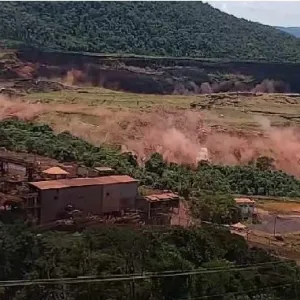
Feijão Dam B-1 (Brazil, 2019)
Harmony Gold Mine No. 4 Tailings Dam (South Africa, 1994)
Panguitch Lake Dam (Utah, 2024)

A Guide to Public Alerts and Warnings for Dam and Levee Emergencies


Federal Guidelines for Dam Safety: Emergency Action Planning for Dams


The Teton Dam Failure - An Effective Warning and Evacuation