Contributor

Contributed By: Lee Mauney, P.E.
Title: Dams Levees and Civil Works Business Class Lead
Organization: HDR
Email: [email protected]
Description & Background
Madison River Canyon Earthquake and Landslide
Just before midnight on August 17, 1959, in the vicinity of Yellowstone National Park in southwest Montana, a Mw 7.3 earthquake caused an estimated 36 to 43 million cubic yard rockslide to rapidly cross the Madison River and continue up the opposite canyon. The earthquake originated in the Intermountain Seismic Belt. This seismically active region spans from northwest Montana to northwestern Arizona and is an area with the potential to generate large-magnitude earthquakes. The Hebgen-Red Canyon Fault ruptured during the earthquake. The epicenter was calculated to be about 8 miles north of the town of West Yellowstone and 12 miles southeast of Hebgen Dam. The fault rupture propagated from the southeast to the northwest towards the dam. This was the deadliest and most severe earthquake on record in Montana and the U.S. Intermountain West, and the shock was felt as far as 350 miles from the epicenter.
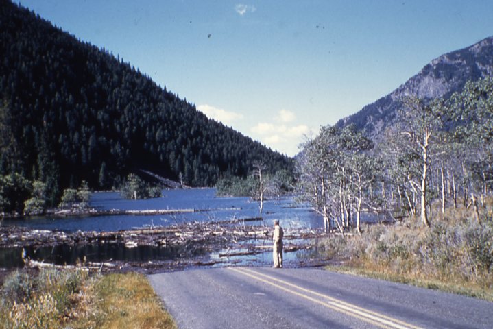
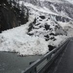
Rockslide debris (200 feet high and 4,000 feet wide) dammed the Madison River, forming Earthquake (Quake) Lake approximately six miles downstream of Hebgen Dam. As the water began rising behind the rock and colluvium slide mass, officials feared that the landslide mass would be overtopped and breached or that water in Quake Lake would rise to the toe of Hebgen Dam, potentially destabilizing that dam. In either case, devastating flooding would occur.
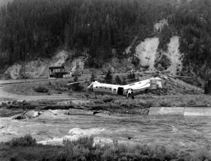
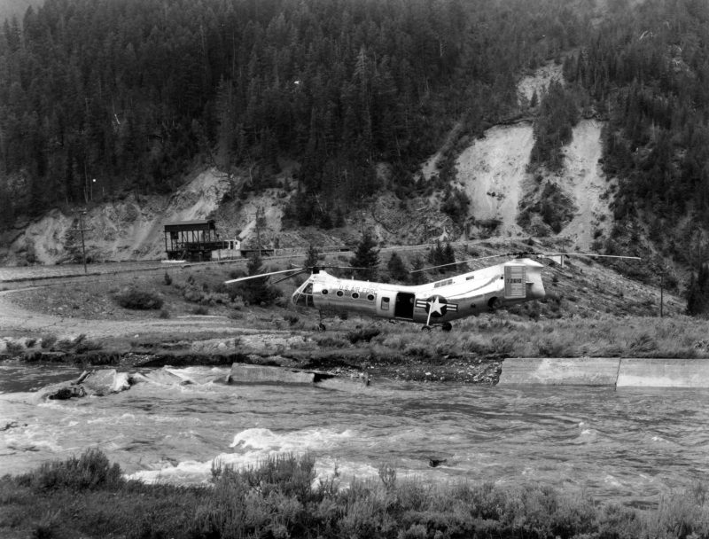
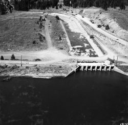
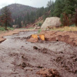
The U.S. Army Corps of Engineers quickly mobilized to address the threat of the landslide dam breaking and releasing the stored water that could flood many miles downstream. With two months of around-the-clock work, a discharge channel was excavated through the slide mass, lowering the lake to a safe level. Fortunately, this event occurred during late summer instead of spring runoff.
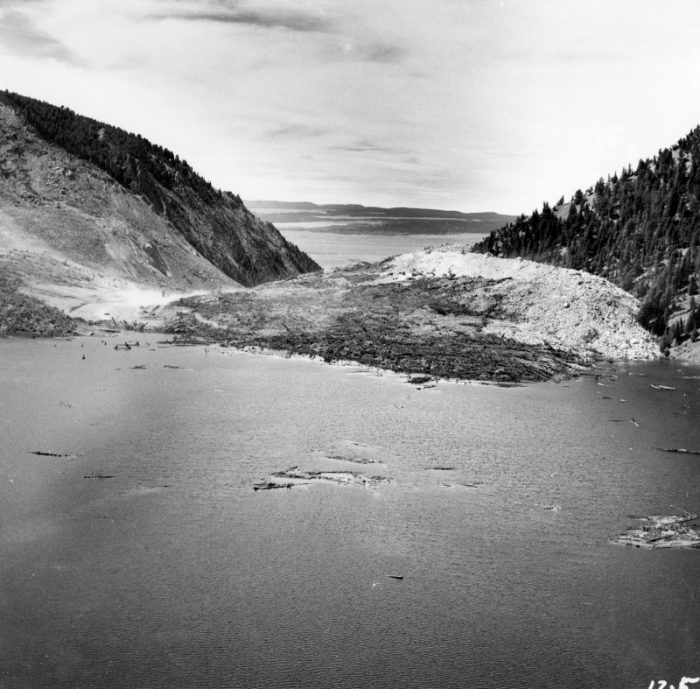
Madison Canyon Slide, scar, and Quake Lake as the water rises. (Photo Source: U.S. Geological Survey)
The earthquake occurred on a calm, clear summer night, at the peak of tourist season, with campgrounds and hotels at full capacity. An estimated 300 people were camping along the Madison River Canyon that evening. Chaos was reported after the slide, with hundreds trapped by the landslide and escape routes destroyed. In order to evade the rising water in Quake Lake, those affected by the quake were forced to move uphill in the dark and find their way through unmarked routes. Authorities were unable to organize until the next morning. There were 28 fatalities in total, with 19 bodies never recovered and likely buried beneath the slide debris. Most fatalities occurred at Rock Creek campground, which was at full capacity, and partially buried during the slide.
Hebgen Dam Incident
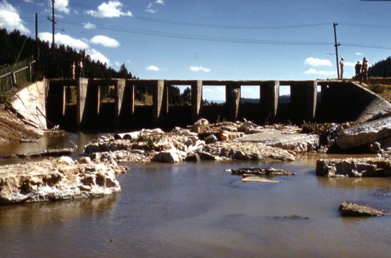
Just upstream of Quake Lake is Hebgen Dam, an 85 feet tall embankment with central concrete core completed from 1910 to 1915 by the Montana Power Company. The reservoir was nearly full (330,000 of 345,000 acre-feet) when the earthquake occurred. At the time of the earthquake, the spillway was releasing around 1,000 cfs. The volume of Hebgen reservoir was nearly four times that which could be accommodated in Quake Lake, so the failure of Hebgen Dam would have caused the overtopping of the landslide debris forming Quake Lake.
The embankment consists of rock- and earth-fill excavated from nearby hillsides and dumped in place from rail cars without compactive efforts, founded on alluvial sand and gravel, with the core wall founded on rock. Located along the Madison River, a tributary of the Missouri River, the dam has a primary outlet works at the left abutment and a concrete-lined spillway on the right abutment.
Associated with the faulting was a general subsidence and tilting of the bedrock underlying the reservoir. The measured subsidence varied between 5 and 22 feet in the vicinity of the reservoir. Large areas of land were exposed on the south side of the lake, and cabins on the north side were now in the lake. The offset on the surface (fault scarps) can still be seen today.
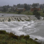
Ground deformations from the earthquake, with an epicenter only about 12 miles upstream from Hebgen Lake, induced a seiche on the reservoir, causing waves to overtop the dam four times with an estimated depth of 3 to 4 feet and overtopping duration of 5 to 10 minutes as observed by the dam tender. The waves caused some relatively minor erosion of the downstream slope and toe.
Impacts to Hebgen Dam from the Earthquake
- Embankment settlement: The earth/rock-fill comprising the shells of the embankment settled relative to the core wall. The large-magnitude earthquake consolidated the

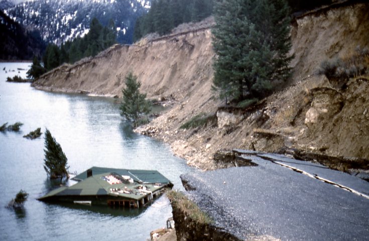
Hilgard Lodge submerged in Hebgen Lake. (Photo Source: U.S. Geological Survey)
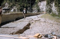
relatively uncompacted material of the dam and the fluvial soils near and under the spillway. The upstream fill, which was saturated and more clayey than the downstream fill, consolidated more than any other part of the dam. Survey of the crest and ground surface immediately after the earthquake indicated that the shells settled as much as 5 feet on the upstream side and 2 feet on the downstream side. Longitudinal cracks also developed on the crest.
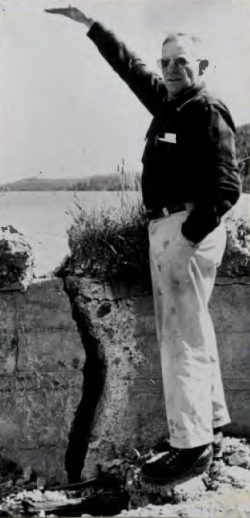
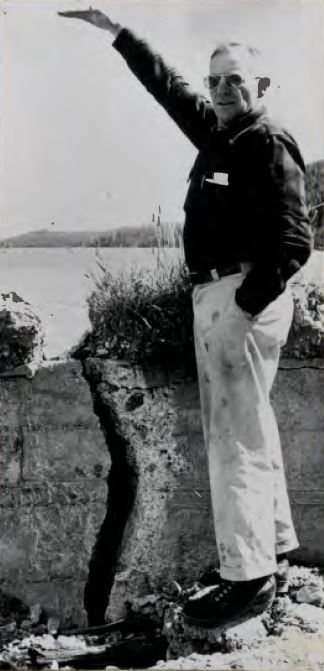
- Cracking of the concrete core wall: The core wall was also found to be deflected as much as one foot downstream for most of its length but as much as three feet upstream at the right abutment adjacent to the spillway. Cracks occurred along the length of the core wall but were most notable towards the right abutment, where depth of the wall changes abruptly from being founded on bedrock to being founded at a shallower depth on alluvial/landslide debris.
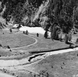
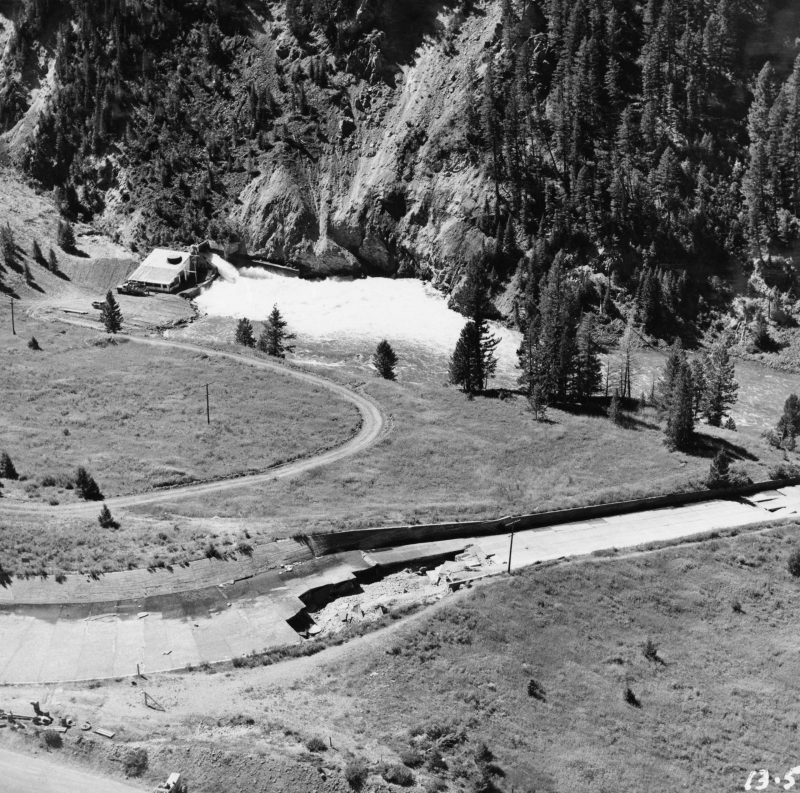
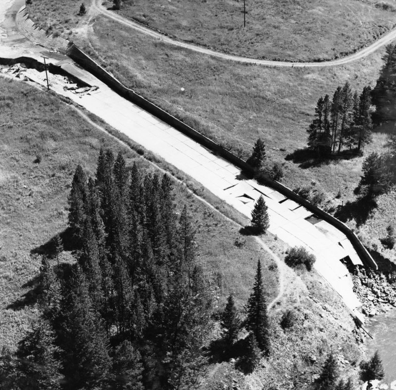
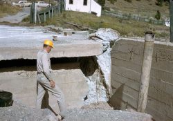
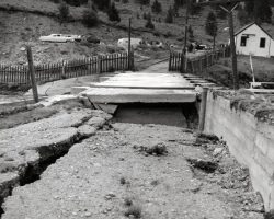
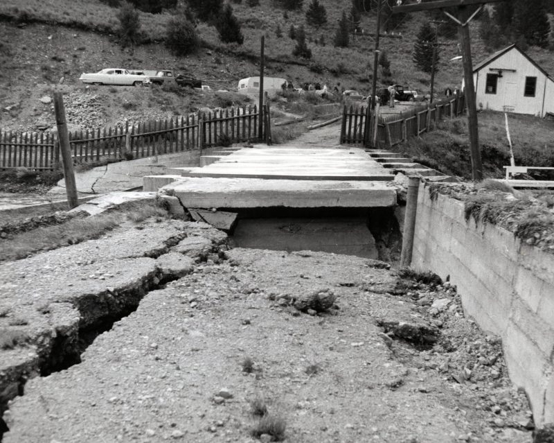
- Significant spillway damages: Cracks in the approach and wing walls and the piers, and severe damage to the chute occurred immediately downstream of the gates.
Fortunately, Hebgen Dam did not breach, and emergency repair work was initiated immediately following the earthquake. The reservoir level was lowered, and areas of erosion and settlement on the downstream side of the dam were filled. The following year, the dam was rehabilitated by adding earthfill along the crest and rebuilding the embankment slopes to their original shape. A new spillway was constructed, and the concrete core wall was repaired by drilling a series of holes to intersect the visible cracks and pumping cement grout into them. In 1971, the embankment crest would be raised to an elevation of 6,546.0 feet to increase freeboard to 11 feet above normal max reservoir level for hydrologic protection. Other modifications of the Hebgen Development included the removal of the powerhouse in 1966, seismic upgrade of the intake tower completed in 2015, reconstruction of the spillway with a seismically upgraded structure in 2016, and relining of the outlet pipe in 2017.
Key Lessons Learned
1. Dams located in seismically active areas should be evaluated for liquefaction, cracking, potential fault offsets, deformations, and settlement due to seismic loading. Hebgen Dam experienced severe shaking, strength loss/slumping of embankment fill, core wall compression and cracking, crest overtopping by multiple seiche waves, and spillway destruction while spilling. Only a series of fortunate circumstances accounted for the fact that the dam did not fail completely. Widespread liquefaction did not occur (although USGS (1964) suggests evidence for some liquefaction), overtopping did not cause significant erosion of the embankment, headcutting did not initiate in the spillway, and the core wall remained mostly intact despite cracking. The bedrock foundation of Hebgen Dam dropped down about 9.7 feet. At the same time, the average subsidence of the entire reservoir bottom was even more. The reservoir water surface elevation dropped by about 10.2 feet, so the freeboard between the top of the concrete core wall and the reservoir increased by about 0.5 feet during the earthquake. If the area around the dam had subsided as much or more than the lakebed, or if a fault rupture occurred below the dam, conditions would have been much worse.
Hebgen Dam after earthquake. (Photo Source: U.S. Geological Survey)
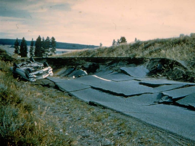
2. Emergency Action Plans can save lives and must be updated, understood, and practiced regularly to be effective. Limited access to the dam site during the earthquake made warning, evacuation, and treatment of injuries challenging. Access roads were severely damaged due to the earthquake, and landslides and fault scarps trapped tourists in the canyon. Some two hundred of the survivors, a number of them critically injured, were caught in the area between the rockslide and the dam and spent the night either around campfires or in their cars. Those in the confines of the canyon downstream from Hebgen Dam moved to high ground to await rescue. One car drove off a scarp trying to evacuate. Rescue teams parachuted in and eventually had to bulldoze emergency trails along the mountainside to evacuate people. Aftershocks also added to the complex rescue efforts. There were six major aftershocks in the two days that followed, all greater than M5.5, making evacuations difficult. Airplanes and helicopters were required to evacuate trapped campers, but not until late the following evening.
Because there was no road access and communication facilities were destroyed, only fragmentary information could be obtained on the day of the earthquake. Emergency response crews thought the dam had or was actively failing, and downstream communities were evacuated. When it comes to responding to dam incidents due to an earthquake, particularly at night, even visual observations can be misleading and incorrect, and confirmation can be restricted and take many hours.
The immediate demands placed on a dam-owning organization will likely be substantial after a significant earthquake. Dam owners and regulators need to prepare for these types of events. The Hebgen Dam incident was ongoing while the evacuations and intervention associated with the nearby landslide were occurring.
3. Dams should be thoroughly assessed for risk using a periodic risk review process including a site inspection, review of original design/construction/performance, and analysis of potential failure modes and consequences of failure. Dam safety risks at Hebgen Dam related to the potential for seismic loading, seiche overtopping, and landslides were not well understood prior to this incident. Hebgen Dam is subject to FERC oversight; therefore, periodic FERC Part 12 reviews are performed, including re-evaluating the safety evaluation earthquake ground motions.
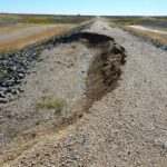
Thorough geotechnical investigations are needed during dam design, specifically evaluating potential landslide impact for dams in mountainous areas (see Vajont Dam). Several large landslides fell into the reservoir during the earthquake but were not close enough to the dam to cause issues. The largest slide occurred about one mile upstream; it had an estimated volume of 350,000 cubic yards and destroyed about a thousand feet of the highway which ran along the edge of the reservoir. The evaluation of dam safety in seismic regions should also include an assessment of the potential for seiches and the impact of wave overtopping.
4. Dams need an operable means of drawing down the reservoir. Control of the reservoir following the 1959 earthquake event was crucial for mitigating post seismic failure modes. The earthquake severely damaged the spillway, and subsequent sustained discharge may have led to a breach. Fortunately, the outlet works were functional for control of the reservoir, including lowering the reservoir for subsequent repairs.
5. Dam failure and incident sites offer an important opportunity for education and memorialization. In 1967, the Forest Service opened the Earthquake Lake Visitor Center, and today, the center receives more than 50,000 visitors annually. The center offers a panoramic view of the landslide, which remains prevalent today, interpretive displays, and a walkway to the Memorial Boulder, which has inscribed the victims' names. A virtual exhibit is also available online.
References:
(5) Kirk, C.H. (1960). The Earthquake Damage to Hebgen Dam and the Necessary Repair Program. 11th Annual Field Conference. Montana Geological Society. 2010.
(10) Benson, S. (2011). Hebgen Dam – A History of Earthquake Hazards and Analyses. 31st Annual USSD Conference and Exhibition. San Diego: United States Society on Dams.
This case study summary was peer-reviewed by Ivan Wong, Lettis Consultants; Khaled Chowdhury, USACE; Stephen Benson, Schnabel; Steve Samuelson, Schnabel; and Dave Gillette, Reclamation.
Summary
Photos
-

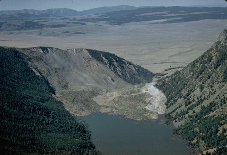
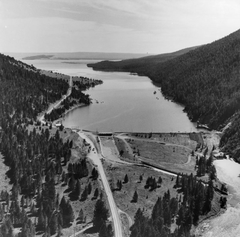
- Aerial view of the Madison Slide and Quake Lake, looking west. (Photo Source: U.S. Forest Service)
-

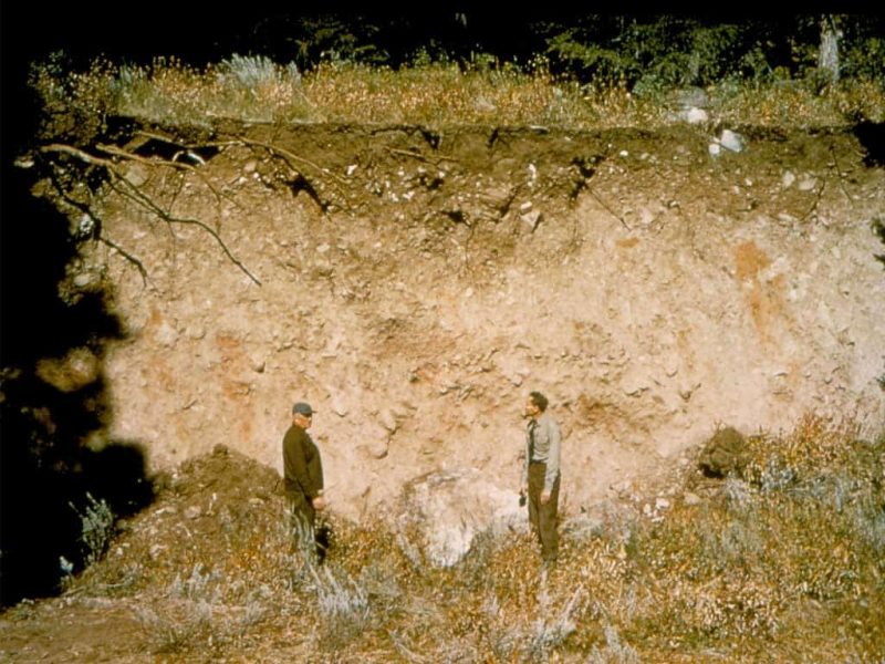
- Earthquake fault scarp. (Photo Source: U.S. Forest Service)
-

- Madison Canyon Slide, scar, and Quake Lake as the water rises. (Photo Source: U.S. Geological Survey)

-

- Quake Lake formed by landslide. (Photo Source: U.S. Geological Survey)
-
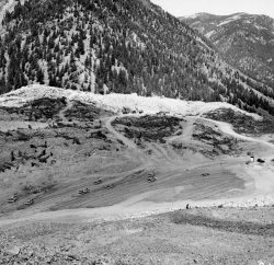
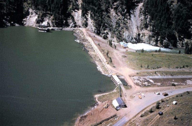
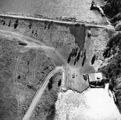
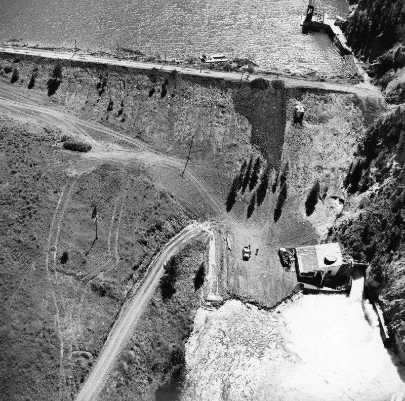
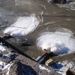
- Heavy equipment constructing a spillway through the Madison Canyon Slide. (Photo Source: U.S. Geological Survey)

-

- Road along canyon. (Photo Source: U.S. Forest Service)
-
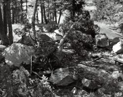
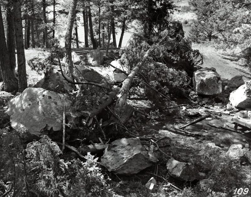
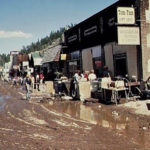
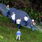
- Cliff Lake Campground. Note camp table with food, smashed car, and large boulder on top of tent. (Photo Source: U.S. Forest Service)
-

- Hilgard Lodge submerged into Hebgen Lake. (Photo Source: U.S. Geological Survey)
-

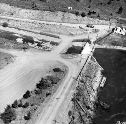
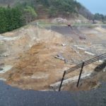
- Hebgen Dam after earthquake. (Photo Source: U.S. Geological Survey)
-
- Hebgen Dam after earthquake. (Photo Source: U.S. Geological Survey)
-

- Hebgen Dam after earthquake. (Photo Source: U.S. Geological Survey)
-
- Hebgen Dam after earthquake. (Photo Source: U.S. Geological Survey)
-
- Hebgen Dam after earthquake. (Photo Source: U.S. Geological Survey)
-
- Hebgen Dam after earthquake. (Photo Source: U.S. Geological Survey)

-

- Hebgen Dam after earthquake. (Photo Source: U.S. Geological Survey)
-
- Hebgen Dam after earthquake. (Photo Source: U.S. Geological Survey)

-
-
George Hungerford (dam tender) described 3-4 foot surges of water overtopping the
Dam, each flowed an estimated 10 minutes before withdrawing. Note the exposed concrete core wall, sod covering the top, and the largest of the cracks in the wall. (Photo Source: U.S. Forest Service)
-
- Cracking along the Hebgen Dam crest. (Photo Source: U.S. Forest Service)

-
- Hebgen Dam after earthquake. (Photo Source: U.S. Forest Service)

-

- Hebgen Dam after earthquake. (Photo Source: U.S. Geological Survey)
-
- The exposed concrete core wall. (Photo Source: U.S. Geological Survey)
-
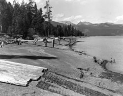
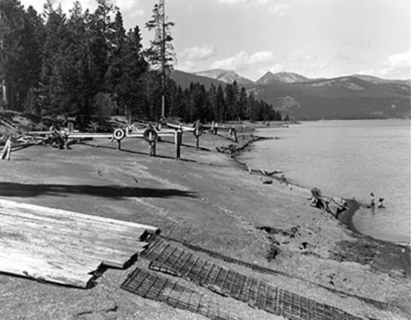
- Hebgen Lake docks exposed after earthquake. (Photo Source: U.S. Forest Service)
Videos
-

- Colling (2011). Hebgen Lake Earthquake – A Survivor Story. Apr 28, 2011. Tootie Greene, a registered nurse, survived the 1959 Hebgen Lake Earthquake and administered aid to the injured until help arrived the following day. This is her story in her own words.
-
- A Force of Nature – Hebgen Lake Earthquake, Jan 14, 2012 Lifes and landscapes were changed in an instant when the Hebgen Lake earthquake shook in 1959. Produced by Gene Colling for US Forest Service.
-

- KTVQ News (2019). 1959 Montana earthquake Part I.
-

- KTVQ News (2019). 1959 Montana earthquake Part II.
-
- ASDSO Webinar: Current Trends in the Seismic Analysis of Embankment Dams
-

- ASDSO Webinar: Lessons Learned Regarding Seismic Deformation Analyses of Embankment Dams from Re-Evaluation of the Upper and Lower San Fernando Dams Performance Case Histories
-
- ASDSO Webinar: Seismic Stability Evaluation of Earth Dams
-
- ASDSO Webinar: Earthquake Hazards, Ground Motions and Dynamic Response
Lessons Learned
All dams need an operable means of drawing down the reservoir.

Dam failure sites offer an important opportunity for education and memorialization.

Dam owners, engineers and regulators need to address public safety at dams.
Dams located in seismic areas should be evaluated for liquefaction, cracking, potential fault offsets, deformations, and settlement due to seismic loading.
Dams should be thoroughly assessed for risk using a periodic risk review process including a site inspection, review of original design/construction/performance, and analysis of potential failure modes and consequences of failure. The completed review supports a case for taking risk-informed actions at individual dams and for prioritizing actions for an inventory of dams.
Dozens of dams can fail or be in danger of failing during a single event (i.e. swarming failures). Dam owners and regulators need to prepare for these types of events.
Earth and rockfill embankment dams must be stable under the full range of anticipated loading conditions.

Emergency Action Plans can save lives and must be updated, understood, and practiced regularly to be effective.
Floods can occur due to unusual or changing hydrologic conditions.
Intervention can stop or minimize consequences of a dam failure. Warning signs should not be ignored.
Natural dams can form quickly through processes such as landslides, avalanches, and river ice jams. In some cases, the formation of natural dams requires prompt intervention to protect people and property.
Additional Lessons Learned (Not Yet Developed)
- Thorough geotechnical investigations are needed during dam design, specifically reservoir slope stability analyses for dams in mountainous areas (landslides). Geo-hazards can exist at dams, even if a structure is considered safe and does not fail.
Other Resources

Federal Guidelines for Dam Safety - Earthquake Analyses and Design of Dams
Author: Federal Emergency Management Agency

Engineering Guidelines for the Evaluation of Hydropower Projects: Chapter 13
Author: FERC
Evaluation of Earthquake Ground Motions

Landslides: Investigation and Mitigation
Author: Transportation Research Board, National Research Council (Turner and Schuster)
Special Report 247

Best Practices and Risk Methodology Chapter H-2
Author: U.S. Bureau of Reclamation & U.S. Army Corps of Engineers
Landslide Risks
Best Practices and Risk Methodology Chapter D-8
Author: U.S. Bureau of Reclamation & U.S. Army Corps of Engineers
Seismic Risks for Embankments

Earthquake Design and Evaluation for Civil Works Projects
Author: United States Army Corps of Engineers (USACE)
Engineer Circular 1110-2-1806

Design Standards No. 13: Embankment Dams - Chapter 13
Author: United States Bureau of Reclamation
Seismic Analysis and Design
Observed Performance of Dams During Earthquakes Vol. 1
Author: United States Society on Dams
Observed Performance of Dams During Earthquakes Vol. 2
Author: United States Society on Dams
Observed Performance of Dams During Earthquakes Vol. 3
Author: United States Society on Dams